Map of College Station, Texas
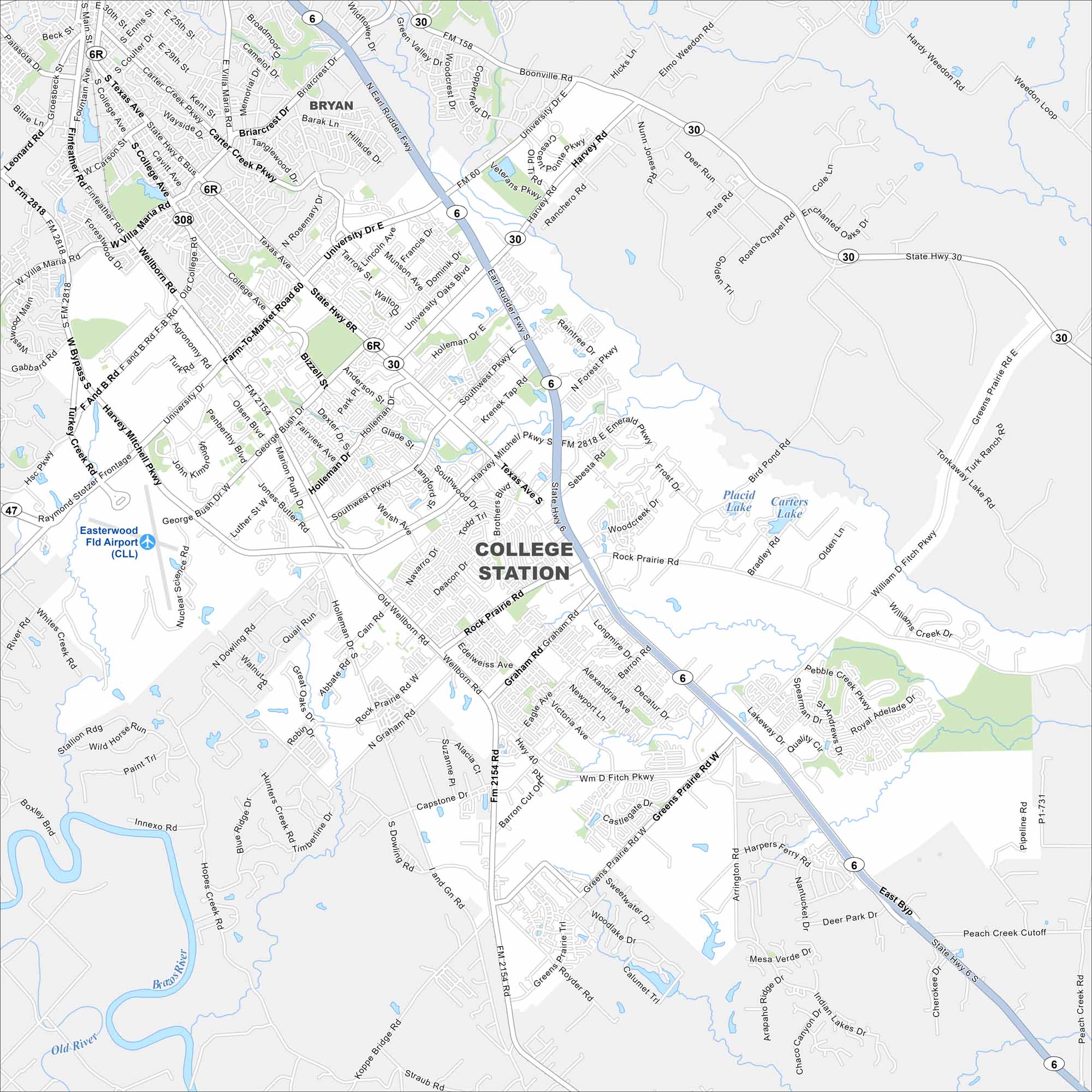
College Station centers on Texas A&M University. The city grew around the campus and spreads across the flat Brazos Valley. Farmland are around on its edges.
Map Information
On the Map
Interstates/Highways: State Rte 6, State Rte 30, State Rte 40, State Rte 308, State Rte 47 Major Roads: University Dr, Texas Ave, Harvey Mitchell Pkwy, Earl Rudder Fwy, Wellborn Rd, Rock Prairie Rd, William D Fitch Pkwy, George Bush Dr, Holleman Dr, Southwest Pkwy, Barron Rd, Graham Rd, Raymond Stotzer Frontage, FM 2818, FM 2154, Villa Maria Rd, Tarrow St, Deacon Dr, Victoria Ave, Greens Prairie Rd Airports: Easterwood Fld Airport Lakes and Reservoirs: Placid Lake, Carters Lake Major Rivers: Brazos River Nearby Communities: BryanTexas State Maps
Scan our maps of the massive southern state of Texas.


City Maps of Texas
Explore our map collection of Texas cities.


