Map of Colorado Springs, Colorado
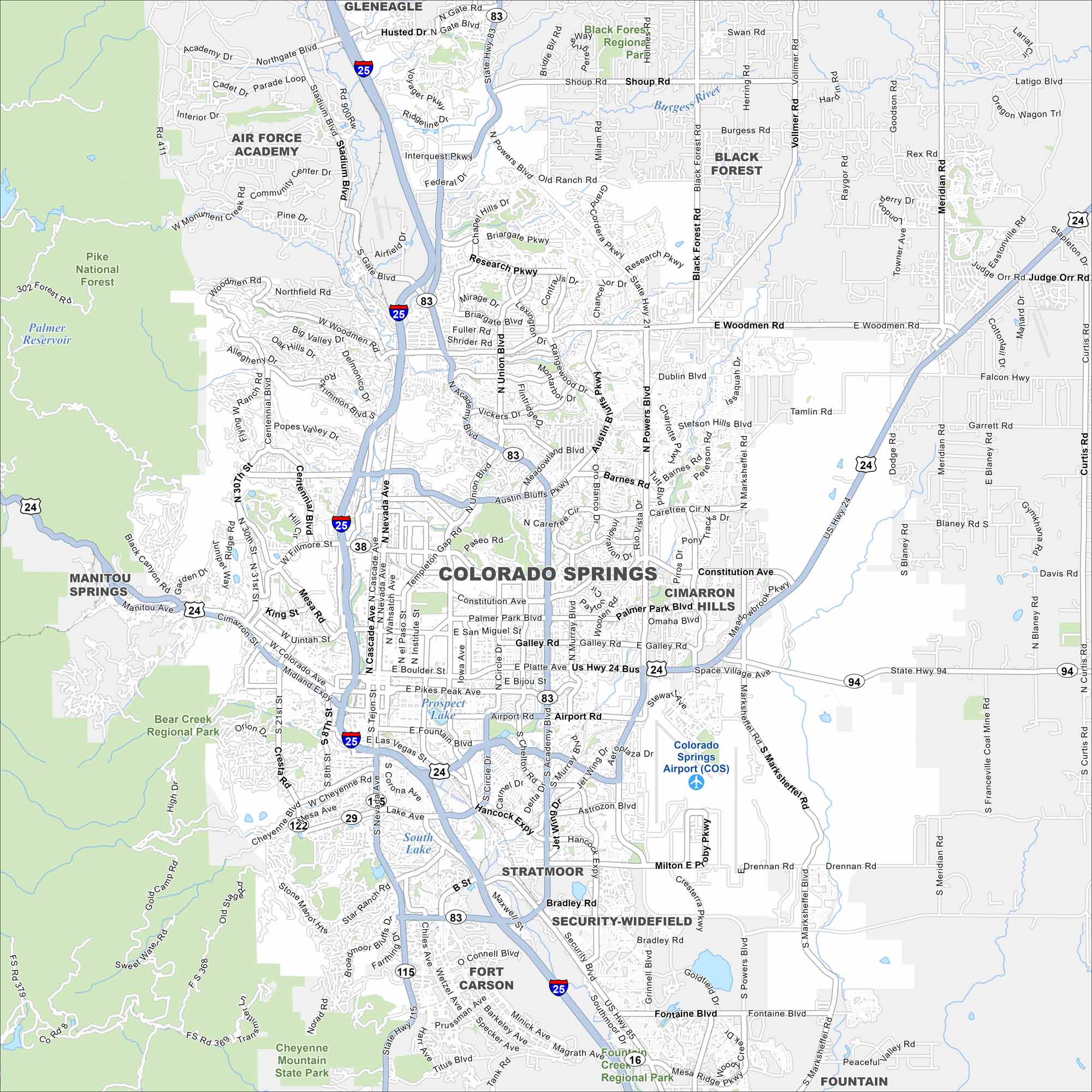
Colorado Springs is situated at the foot of Pikes Peak so the city is surrounded by quite the scenery. The Garden of the Gods sits just west of downtown. Our map shows its streets, highways, and state parks/forests.
Colorado State Maps
Browse Colorado with our detailed state maps


Map Information
On the Map
Interstates/Highways: I-25, State Rte 16, State Rte 21, State Rte 29, State Rte 38, State Rte 83, State Rte 115, US Hwy 24 Major Roads: Academy Blvd, Powers Blvd, Woodmen Rd, Union Blvd, Nevada Ave, Cascade Ave, Platte Ave, Fountain Blvd, Circle Dr, Hancock Expy, Airport Rd, Constitution Ave, Barnes Rd, Carefree Cir, Austin Bluffs Pkwy, Briargate Pkwy, Research Pkwy, Fillmore St, Uintah St, Cheyenne Mountain Blvd Airports: Colorado Springs Airport (COS) Lakes and Reservoirs: Prospect Lake, South Lake, Quail Lake Parks and Preserves: Pike National Forest, Bear Creek Regional Park, Cheyenne Mountain State Park, Palmer Park, Black Forest Regional Park, Crews Gulch Regional Park Nearby Communities: Gleneagle, Air Force Academy, Black Forest, Manitou Springs, Cimarron Hills, Stratmoor, Security-Widefield, Fort Carson, FountainColorado City Maps
Here are maps of Colorado’s urban areas


