Map of Conway, Arkansas
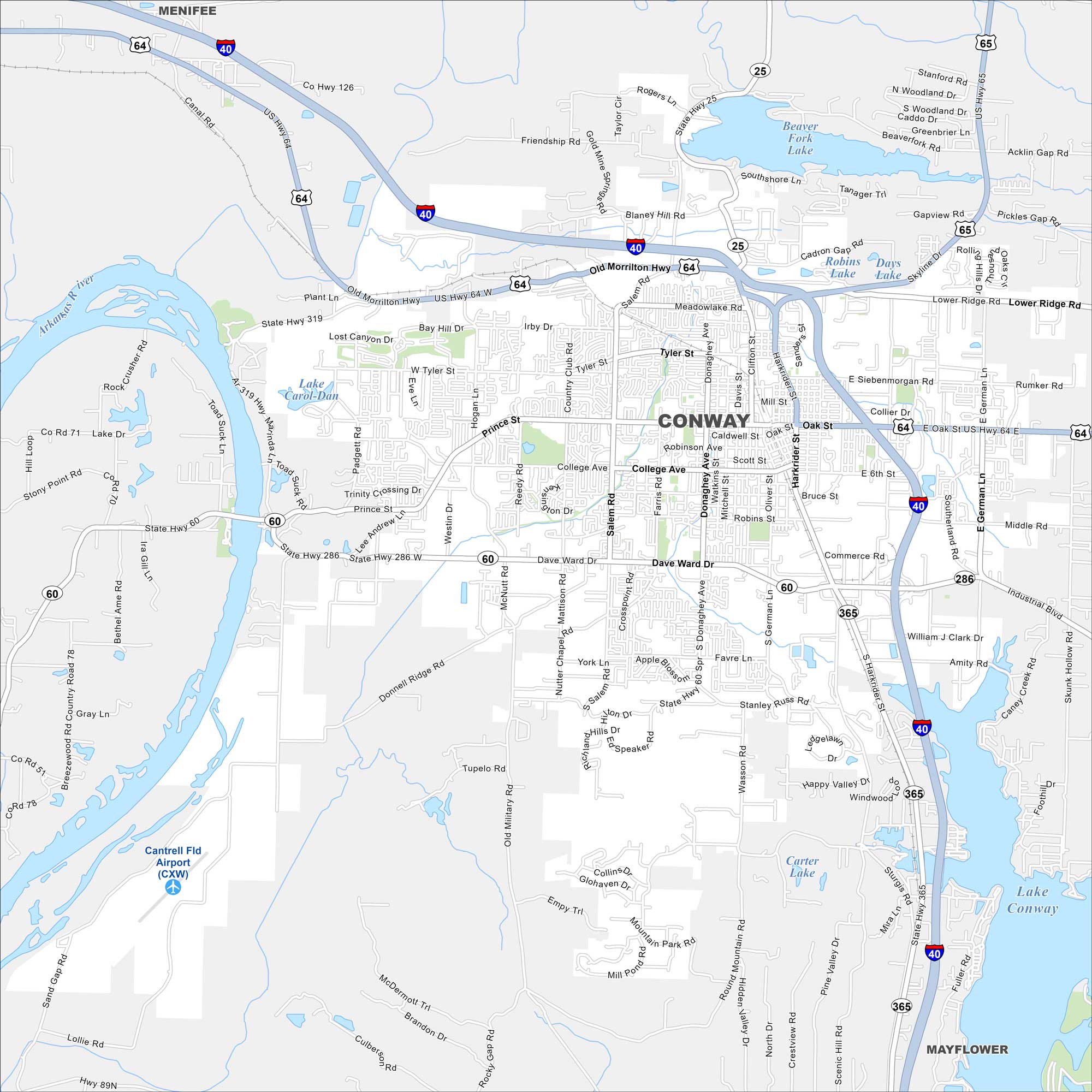
Our map of Conway highlights US-64 and its downtown streets. Just north of Little Rock, it’s called the “City of Colleges”. The Arkansas River runs close by on the west side.
Arkansas State Maps
Check out our Arkansas maps here


Map Information
On the Map
Interstates/Highways: I-40, US Hwy 65, US Hwy 64, State Hwy 60, State Hwy 286, State Hwy 365, State Hwy 319, State Hwy 25 Major Roads: Walton Blvd, Harkrider St, Dave Ward Dr, Oak St, Salem Rd, German Ln, Donaghey Ave, College Ave, Prince St, Tyler St, Siebenmorgan Rd, Hogan Ln, Farris Rd, Reedy Rd, Padgett Rd, Skyline Dr, Old Morrilton Hwy, Lower Ridge Rd, Lollie Rd, Sturgis Rd Airports: Cantrell Fld Airport (CXW) Lakes and Reservoirs: Lake Conway, Beaver Fork Lake, Lake Carol-Dan, Robins Lake, Days Lake, Carter Lake Major Rivers: Arkansas River Nearby Communities: Menifee, MayflowerArkansas City Maps
Discover Arkansas through our city maps


