Map of West Des Moines, Iowa
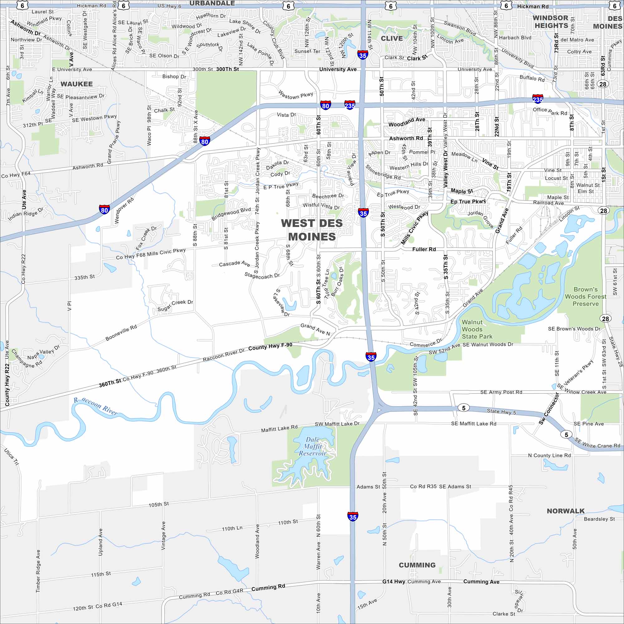
Take a look at West Des Moines on our road map. It’s a thriving suburb with trails, lakes, and a busy retail district. You’ll find it at the intersection of I-35, I-80 and I-235.


Map Information
On the Map
Interstates/Highways: I-35, I-80, I-235, US Hwy 6, State Hwy 5, State Hwy 28 Major Roads: University Ave, Mills Civic Pkwy, Grand Ave, Ashworth Rd, Hickman Rd, E P True Pkwy, Raccoon River Dr, 60th St, 50th St, 35th St, 1st St, Fuller Rd, Army Post Rd, Maffitt Lake Rd, Booneville Rd, Cumming Rd, Railroad Ave, Vista Dr, Westown Pkwy, 88th St Lakes and Reservoirs: Dale Maffitt Reservoir Major Rivers: Raccoon River Parks and Preserves: Walnut Woods State Park, Brown’s Woods Forest Preserve Nearby Communities: Waukee, Clive, Urbandale, Windsor Heights, Des Moines, Norwalk, CummingIowa City Maps
Browse city maps in the state of Iowa


