Map of Cottage Grove, Minnesota
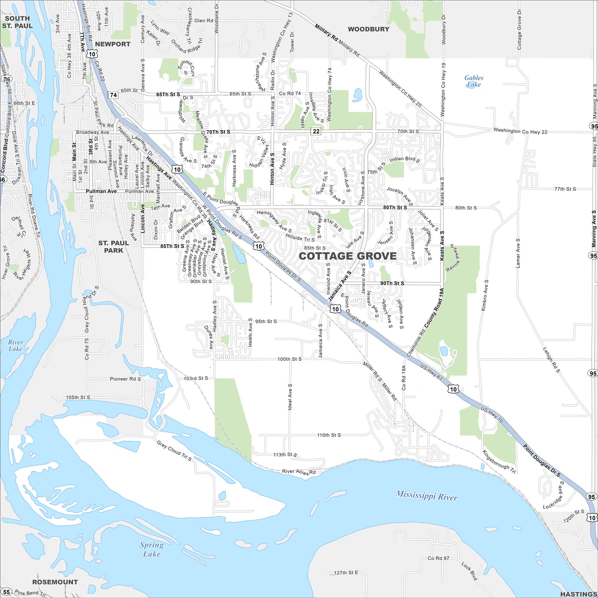
Cottage Grove shows up here with roads, highways, and river access. You can find it along the Mississippi. It’s also situated south of St. Paul with open countryside.
Map Information
On the Map
Interstates/Highways: US Hwy 10 Major Roads: 80th St, 70th St, 95th St, 110th St, Jamaica Ave, Keats Ave, Hinton Ave, Military Rd, Belden Blvd, Hadley Ave, Ideal Ave, Hemingway Ave, Manning Ave, Hardwood Ave, Point Douglas Rd, 65th St, Indian Blvd, Lamar Ave, Grey Cloud Trl Lakes and Reservoirs: Spring Lake, Gables Lake Major Rivers: Mississippi River Nearby Communities: Newport, St. Paul Park, South St. Paul, Woodbury, Hastings, RosemountMinnesota State Maps
Explore every lake in our state maps of Minnesota


Minnesota City Maps
Browse through our city maps of Minnesota


