Map of Davenport, Iowa
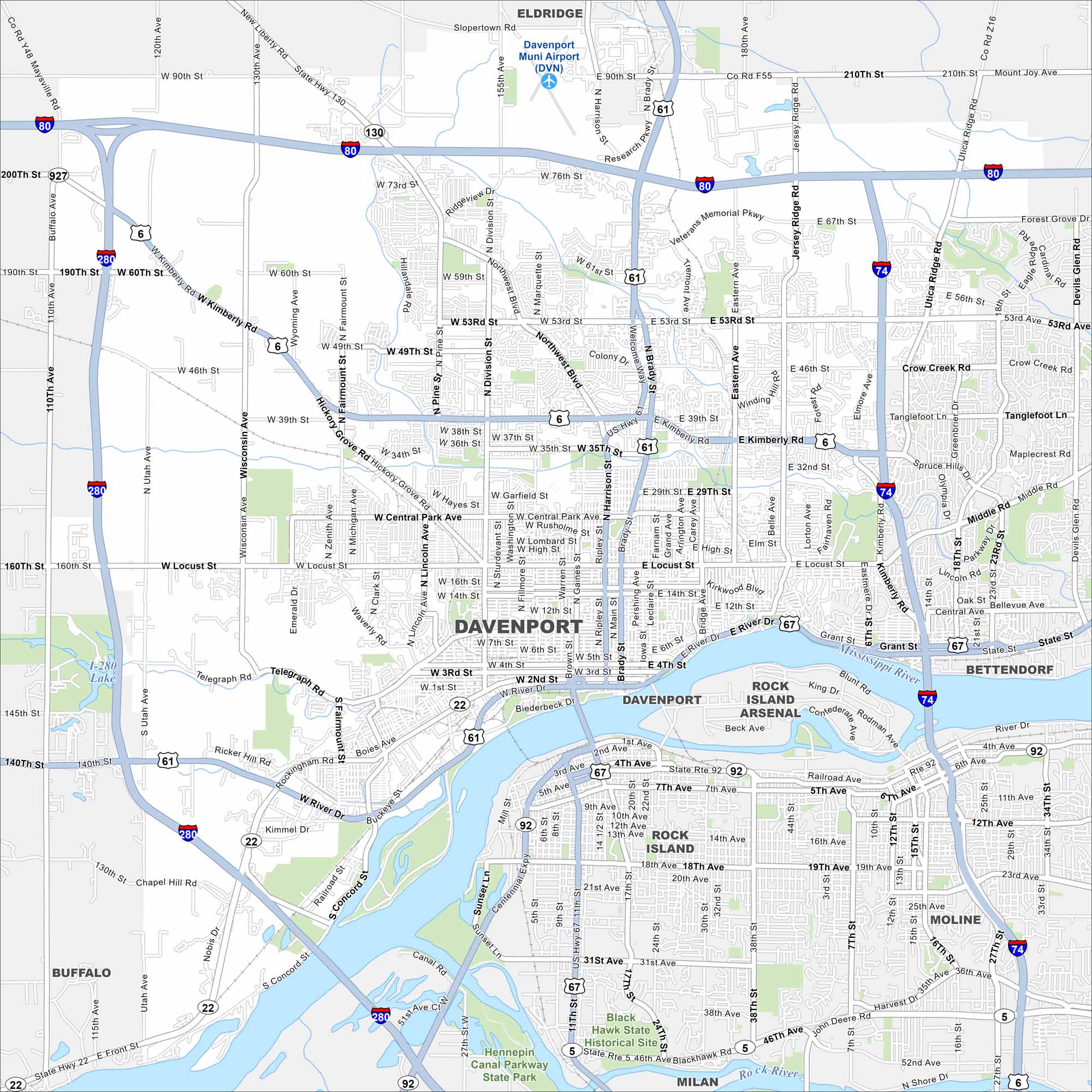
Look over Davenport with its mapped streets, highways, and the Mississippi River on its edge. The city is part of the Quad Cities. Bridges link Iowa to Illinois.


Map Information
On the Map
Interstates/Highways: I-80, I-74, I-280, US Hwy 6, US Hwy 61, US Hwy 67, State Hwy 130, State Hwy 22, State Hwy 461 Major Roads: Brady St, Harrison St, Kimberly Rd, Locust St, 53rd St, Welcome Way, Northwest Blvd, Division St, Hickory Grove Rd, Rockingham Rd, River Dr, 2nd St, 3rd St, 4th St, 12th St, Central Park Ave, Telegraph Rd, Wisconsin Ave, Jersey Ridge Rd, Eastern Ave Airports: Davenport Muni Airport (DVN) Lakes and Reservoirs: Major Rivers: Mississippi River Nearby Communities: Eldridge, Bettendorf, Rock Island, Moline, Buffalo, Milan, Rock Island ArsenalIowa City Maps
Browse city maps in the state of Iowa


