Map of Deer Park, Texas
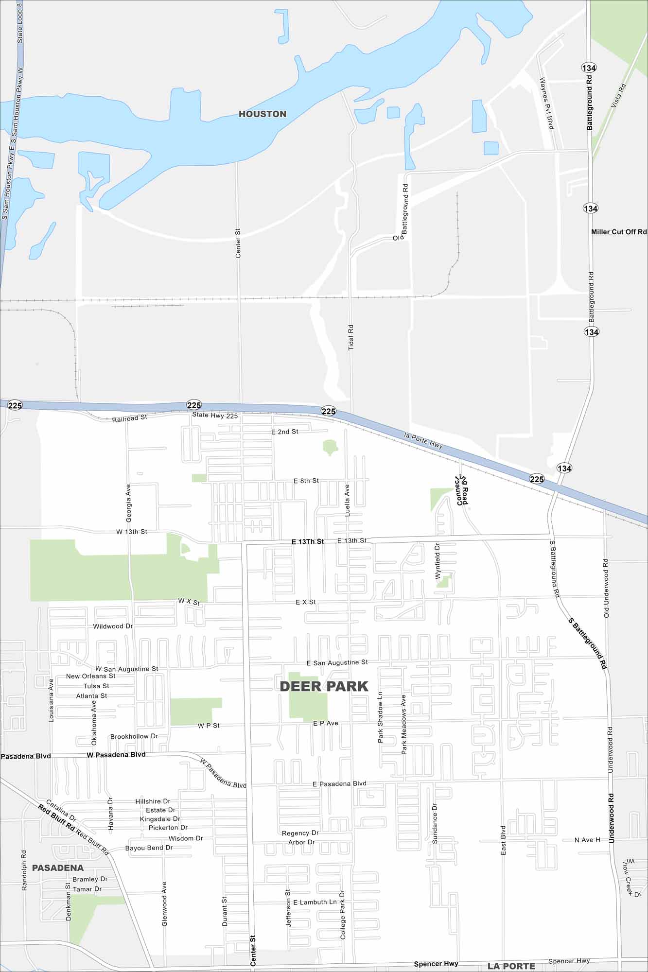
Deer Park is mapped with its major roads, highways, and nearby bayous. The city sits beside Houston and is part of the region’s industrial core.
Map Information
On the Map
Interstates/Highways: State Hwy 225 Major Roads: Center St, Spencer Hwy, Pasadena Blvd, Battleground Rd, Red Bluff Rd, E 13th St, San Augustine St, Georgia Ave, Luella Ave, Underwood Rd, Tidal Rd, Miller Cut Off Rd, Vista Rd, Railroad St, La Porte Hwy, Bayou Bend Dr, Wisdom Dr Nearby Communities: Houston, Pasadena, La PorteTexas State Maps
Scan our maps of the massive southern state of Texas.


City Maps of Texas
Explore our map collection of Texas cities.


