Map of West Memphis, Arkansas
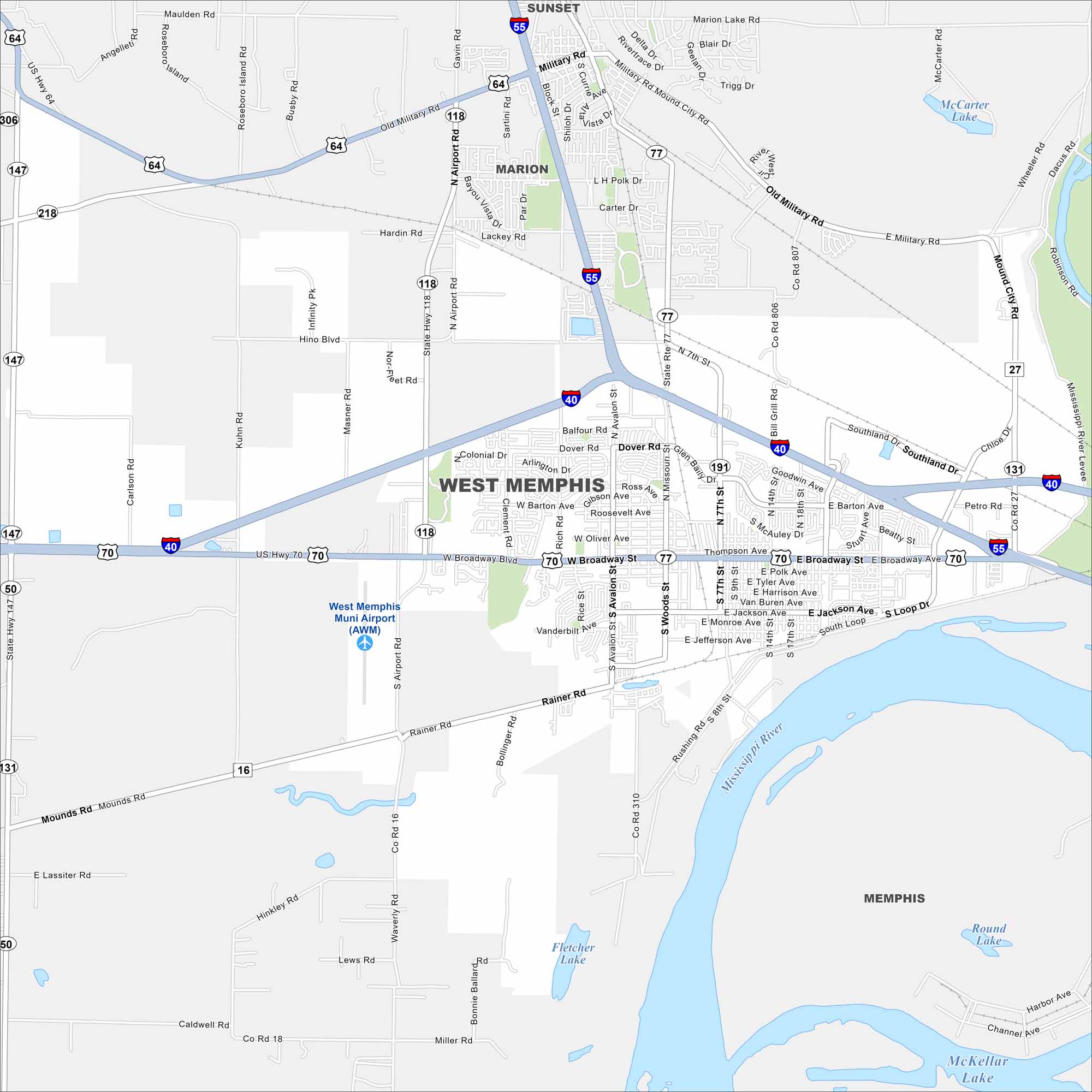
Start with this map of West Memphis across the Mississippi River from Memphis. Our map shows the main interstates, highways, and riverfront access.
Arkansas State Maps
Check out our Arkansas maps here


Map Information
On the Map
Interstates/Highways: I-40, I-55, US Hwy 70, US Hwy 79, US Hwy 64, State Hwy 77, State Hwy 118, State Hwy 191, State Hwy 131, State Hwy 147, State Hwy 218 Major Roads: Broadway St, Missouri St, Avalon St, Service Rd, Seventh St, Airport Rd, Woods St, Jefferson Ave, Polk Ave, Tyler Ave, Harrison Ave, Jackson Ave, Monroe Ave, Rainer Rd, Bollinger Rd, Dover Rd, Balfour Rd, Rich Rd, Rice St, Vanderbilt Ave Airports: West Memphis Muni Airport (AWM) Lakes and Reservoirs: Fletcher Lake, Dacus Lake, McCarter Lake Major Rivers: Mississippi River Nearby Communities: Marion, Sunset, MemphisArkansas City Maps
Discover Arkansas through our city maps


