Map of Duluth, Minnesota
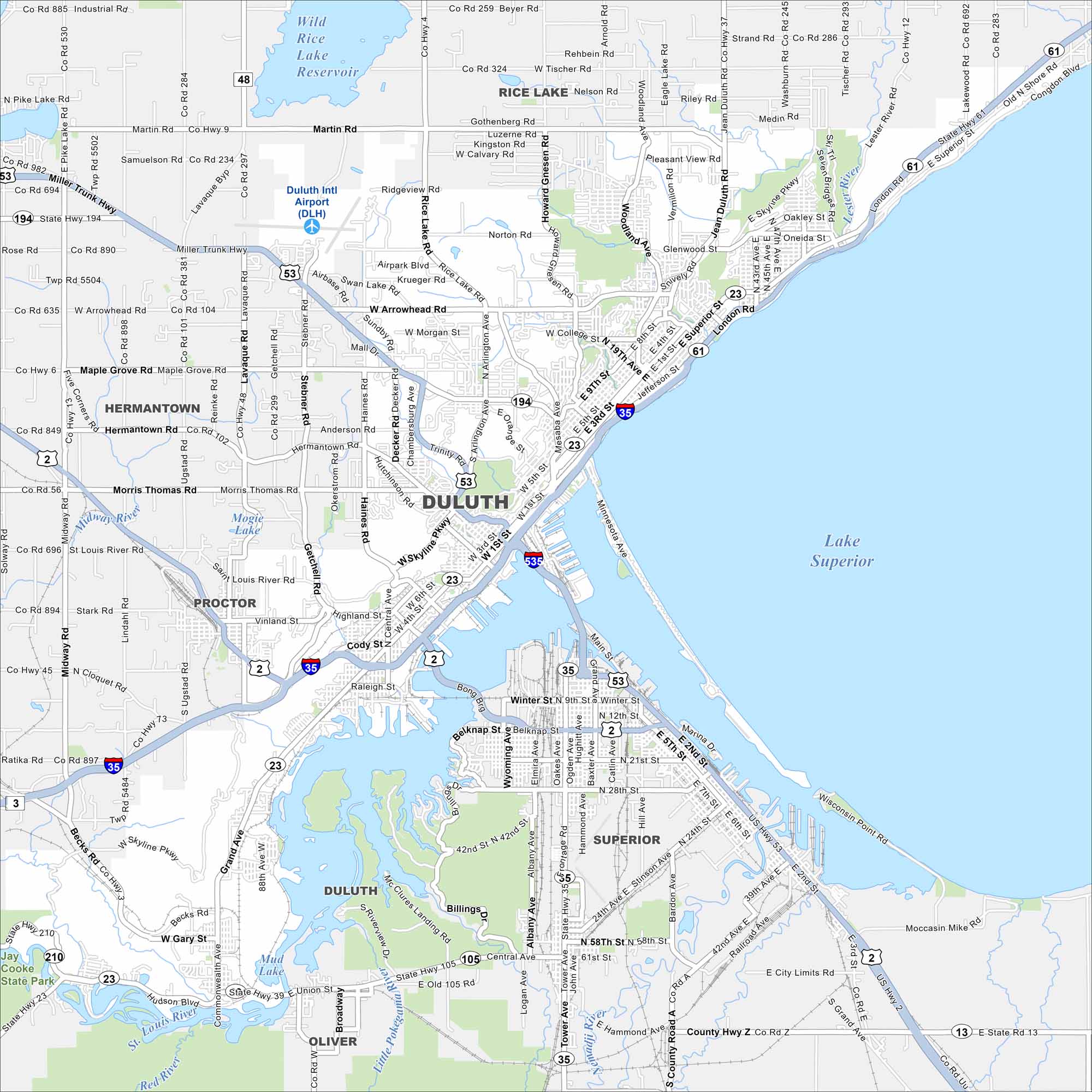
Duluth sits on the western tip of Lake Superior. Our map of the city shows the harbor, lift bridge, and hillside streets. It’s often called the “Zenith City” because of its perch above the great lake.
Map Information
On the Map
Interstates/Highways: I-35, US Hwy 2, US Hwy 53, State Rte 61, State Rte 194, State Rte 23 Major Roads: Superior St, London Rd, Skyline Pkwy, Central Entrance, Miller Trunk Hwy, Arrowhead Rd, Grand Ave, Woodland Ave, 21st St, 40th Ave, Piedmont Ave, Mesaba Ave, 4th St, Trinity Rd, Haines Rd, Rice Lake Rd, Glenwood St, Jean Duluth Rd, Commonwealth Ave Airports: Duluth Intl Airport (DLH) Lakes and Reservoirs: Lake Superior, Wild Rice Lake Reservoir, Mud Lake Major Rivers: Nemadji River, Red River, Midway River Parks and Preserves: Jay Cooke State Park Nearby Communities: Hermantown, Proctor, Rice Lake, Superior, OliverMinnesota State Maps
Explore every lake in our state maps of Minnesota


Minnesota City Maps
Browse through our city maps of Minnesota


