Map of Eagle Pass, Texas
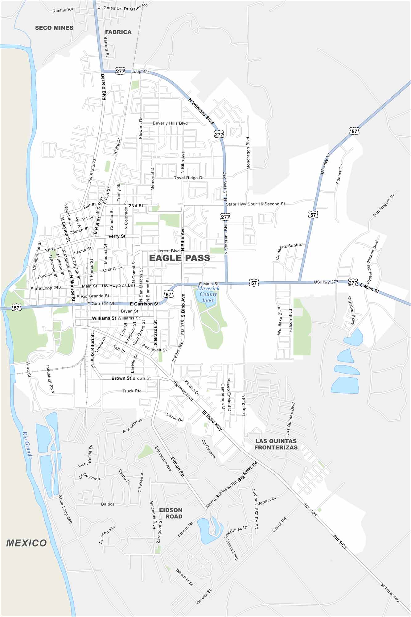
Eagle Pass sits right on the Rio Grande, across from Mexico. The river forms its southern boundary on the map. It’s a true border city with strong cultural and economic ties to Piedras Negras.
Map Information
On the Map
Interstates/Highways: US Hwy 57, US Hwy 277, State Rte 131 Major Roads: Main St, Garrison St, El Indio Hwy, Eidson Rd, Bibb Ave, Veterans Blvd, Del Rio Blvd, Ferry St, Second St, Industrial Blvd, Monroe St, Ceylon St, Medina St, Comal St, Blanco St, Roosevelt St, Brown St, Memorial Dr, Flowers Dr, Hillcrest Blvd Lakes and Reservoirs: Maverick County Lake Major Rivers: Rio Grande Nearby Communities: Seco Mines, Fabrica, Eidson Road, Las Quintas Fronterizas, MexicoTexas State Maps
Scan our maps of the massive southern state of Texas.


City Maps of Texas
Explore our map collection of Texas cities.


