Map of Eden Prairie, Minnesota
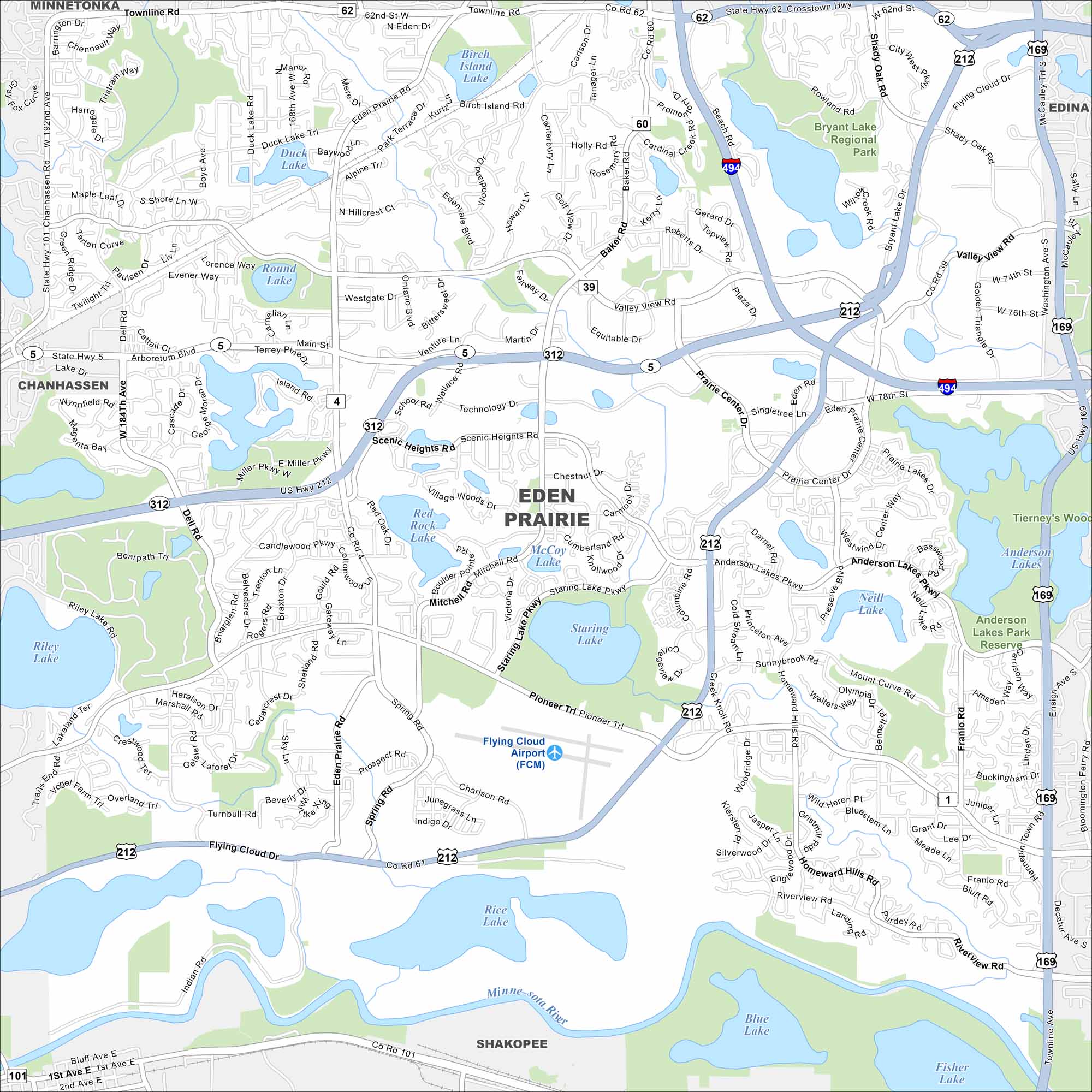
Our map of Eden Prairie shows lakes scattered throughout the city, including Staring and Red Rock Lake. Highways connect it closely to Minneapolis. It’s often called one of Minnesota’s most livable suburbs.
Map Information
On the Map
Interstates/Highways: I-494, US Hwy 212, US Hwy 169, State Rte 62, State Rte 5 Major Roads: Prairie Center Dr, Flying Cloud Dr, Valley View Rd, Dell Rd, Mitchell Rd, Eden Prairie Rd, Pioneer Trl, Scenic Heights Rd, Terrey Pine Rd, Baker Rd, Wallace Rd, Anderson Lakes Pkwy, Charlson Rd, Singletree Ln, Technology Dr, Venture Ln, Main St, Equitable Dr, Martin Dr, Westbury Dr Airports: Flying Cloud Airport (FCM) Lakes and Reservoirs: Rice Lake, Staring Lake, Red Rock Lake, Bryant Lake, Neill Lake, Anderson Lakes, Round Lake, Duck Lake, Birch Island Lake, McCoy Lake, Mitchell Lake, Riley Lake, Blue Lake, Fisher Lake Major Rivers: Minnesota River Parks and Preserves: Bryant Lake Regional Park, Anderson Lakes Park Reserve Nearby Communities: Chanhassen, Edina, Bloomington, Shakopee, MinnetonkaMinnesota State Maps
Explore every lake in our state maps of Minnesota


Minnesota City Maps
Browse through our city maps of Minnesota


