Map of Edinburg, Texas
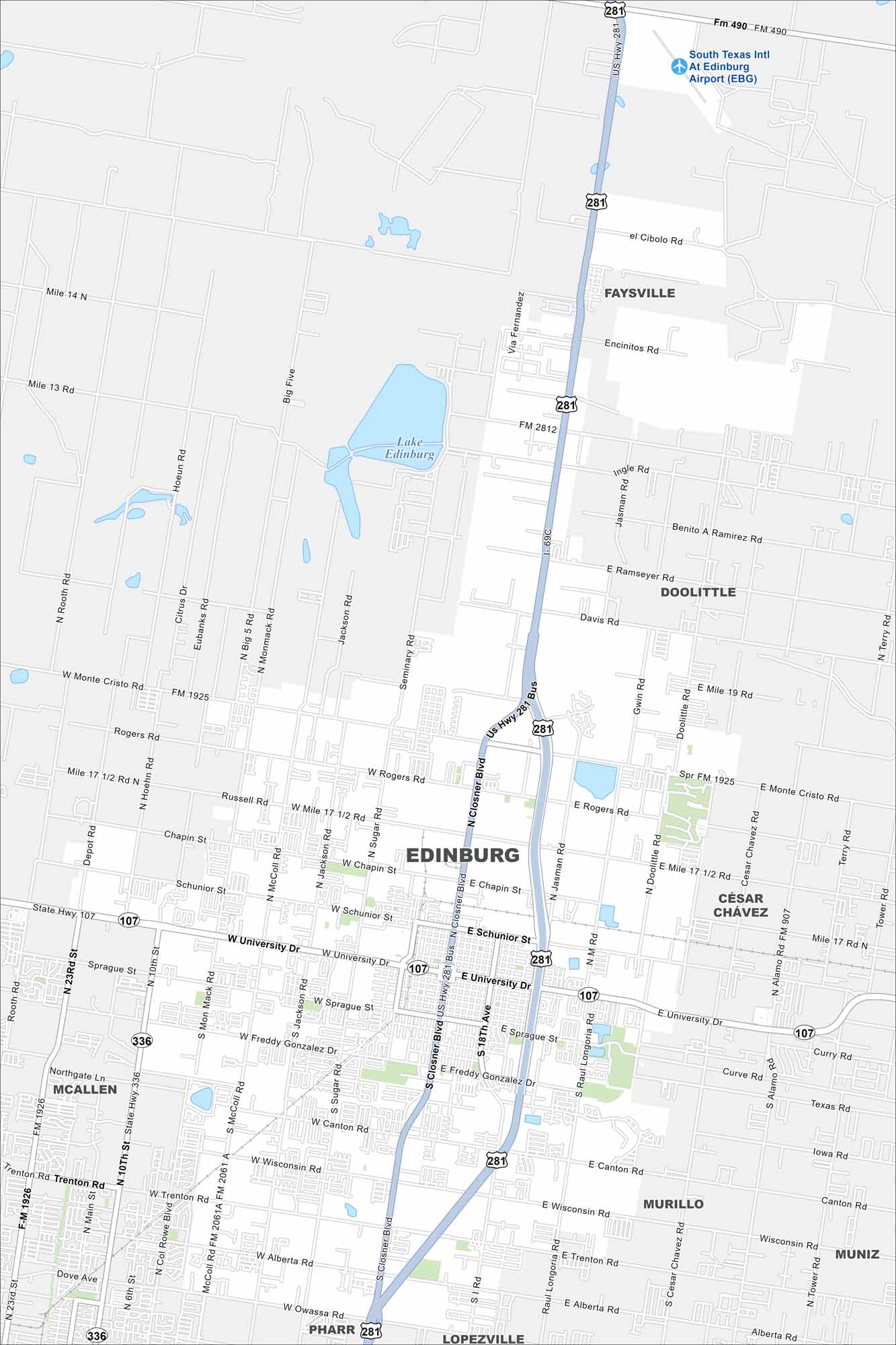
Edinburg spreads across the Rio Grande Valley. Our map shows highways leading toward McAllen and the Mexican border. It’s part of a fast-growing metro area in Texas.
Map Information
On the Map
Interstates/Highways: I-69C, US Hwy 281, State Rte 107, State Rte 336 Major Roads: University Dr, University Dr, Closner Blvd, Monte Cristo Rd, Rogers Rd, Schunior St, Sprague St, Freddy Gonzalez Dr, Wisconsin Rd, Canton Rd, Alberta Rd, Owassa Rd, 10th St, 23rd St, Rooth Rd, Monmack Rd, Sugar Rd, 18th St, McColl Rd, Jackson Rd Airports: South Texas Intl At Edinburg Airport (EBG) Lakes and Reservoirs: Lake Edinburg Nearby Communities: McAllen, Pharr, Lopezville, Murillo, Muniz, Cesar Chavez, Doolittle, FaysvilleTexas State Maps
Scan our maps of the massive southern state of Texas.


City Maps of Texas
Explore our map collection of Texas cities.


