Map of Englewood, Colorado
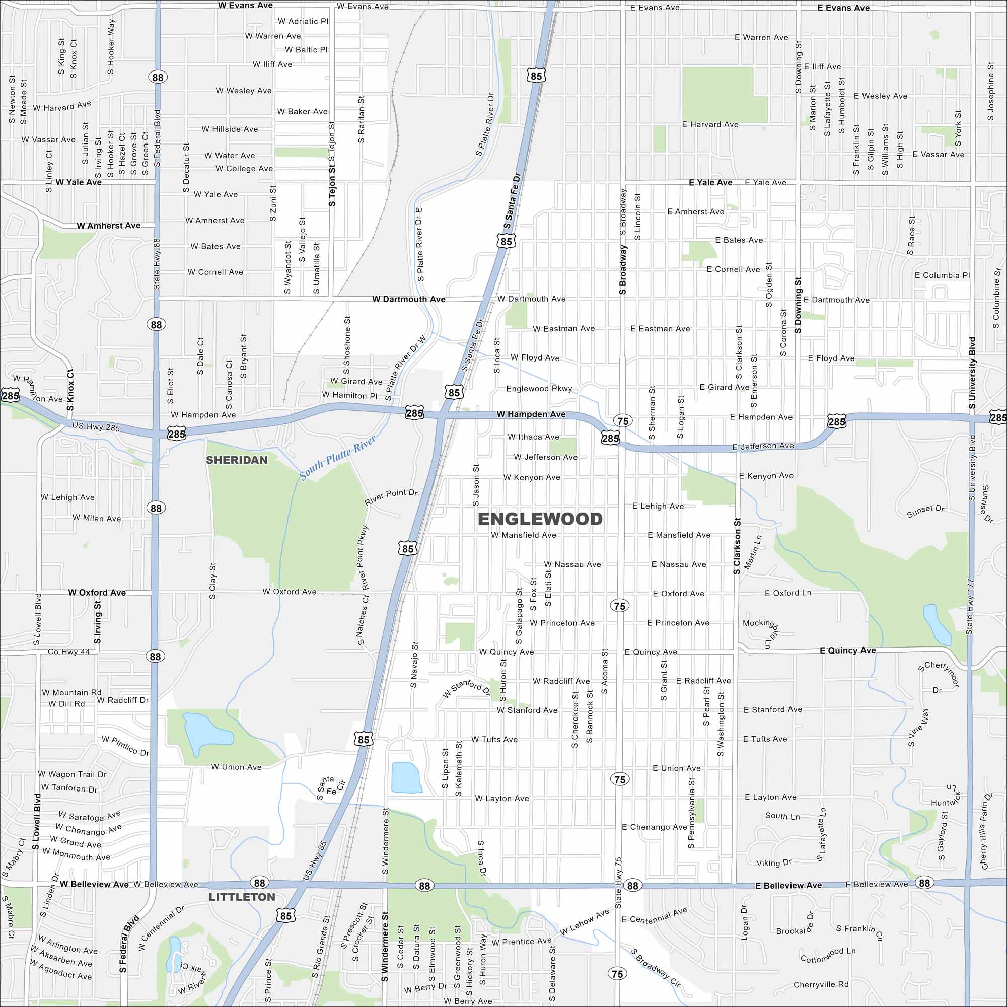
Englewood borders Denver to the south. U.S. 285 cuts across the city toward the foothills. Its views of the Rocky Mountains are an absolute standout here.
Colorado State Maps
Browse Colorado with our detailed state maps


Map Information
On the Map
Interstates/Highways: US Hwy 285, US Hwy 85, State Rte 88, State Rte 75, State Rte 177 Major Roads: Hampden Ave, Santa Fe Dr, Federal Blvd, Broadway, University Blvd, Belleview Ave, Evans Ave, Dartmouth Ave, Oxford Ave, Quincy Ave, Union Ave, Yale Ave, Sheridan Blvd, Lowell Blvd, Downing St, Colorado Blvd Major Rivers: South Platte River Nearby Communities: Sheridan, Littleton, Cherry Hills VillageColorado City Maps
Here are maps of Colorado’s urban areas


