Map of Enid, Oklahoma
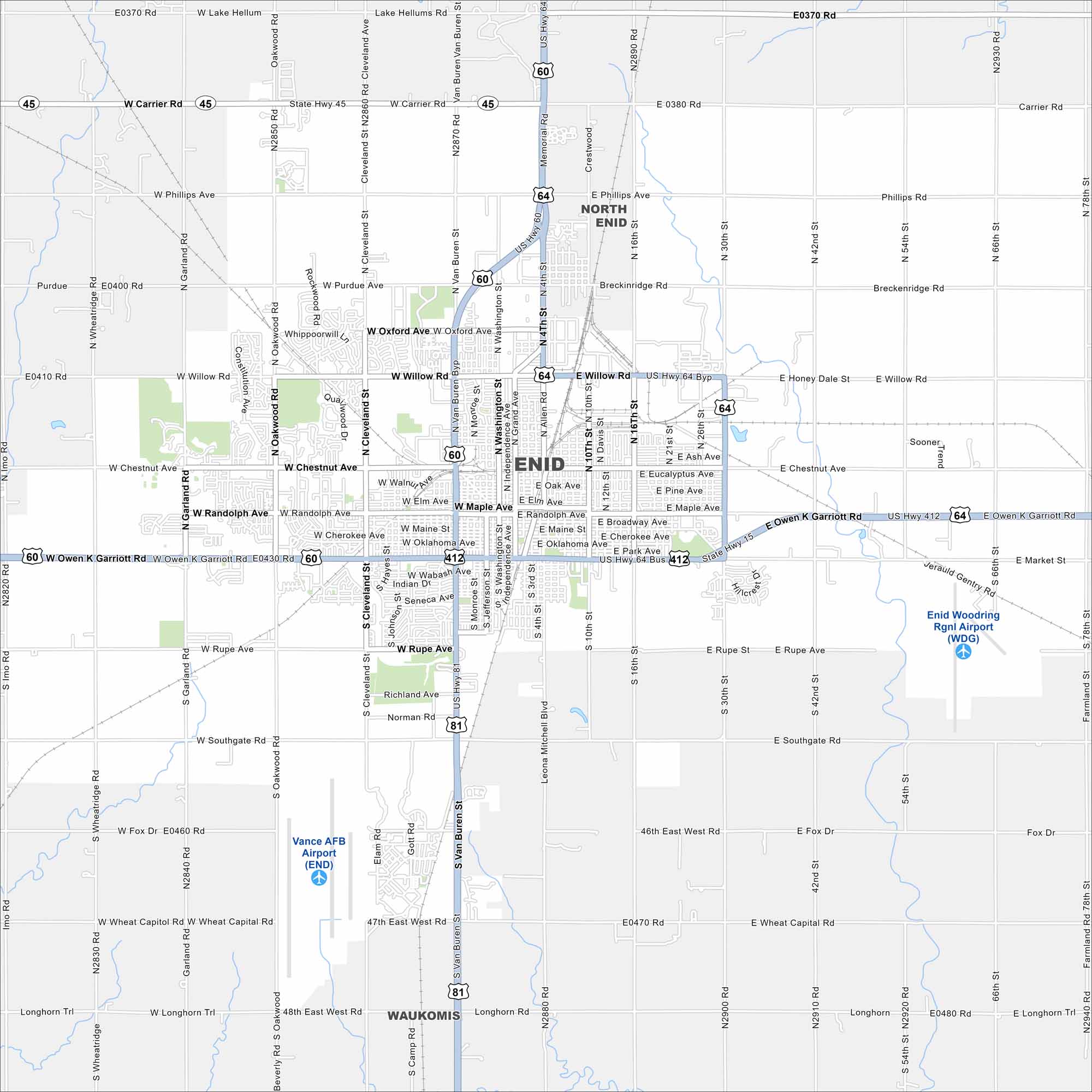
Enid spreads out in north-central Oklahoma’s flat plains. U.S. 60, 64, and 81 all meet here. The wide grid of roads reflects its prairie setting.
Map Information
On the Map
Interstates/Highways: US Hwy 81, US Hwy 64, US Hwy 60, US Hwy 412, State Rte 45 Major Roads: Owen K Garriott Rd, Van Buren St, Cleveland St, Oakwood Rd, Grand Ave, Washington St, 4th St, 10th St, 16th St, 30th St, 42nd St, Willow Rd, Chestnut Ave, Randolph Ave, Maine St, Broadway Ave, Rupe Ave, Southgate Rd, Phillips Ave, Oxford Ave Airports: Enid Woodring Rgnl Airport (WDG), Vance AFB Airport (END) Nearby Communities: North Enid, WaukomisOklahoma State Maps
Here is our map collection of the Sooner State.


City Maps of Oklahoma
Explore Oklahoma’s cities with our maps


