Map of Westfield, Massachusetts
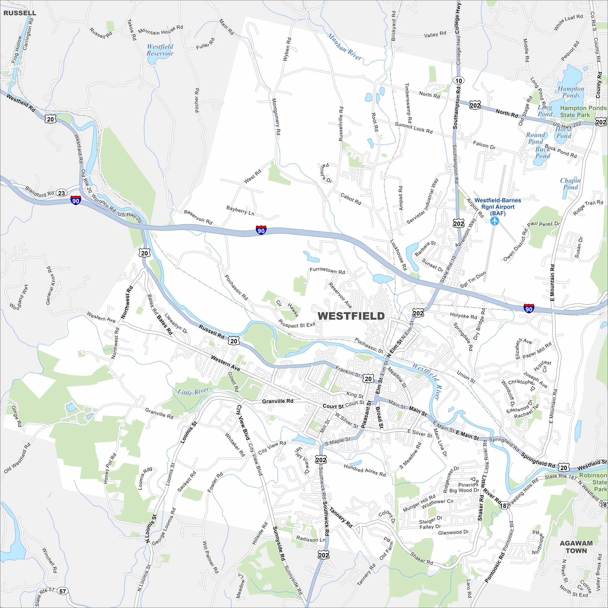
Here’s a simple map of Westfield, Massachusetts. You’ll find this city along the Westfield River. The city blends historic mills with a college community.
Map Information
On the Map
Interstates/Highways: I-90, US Hwy 20, State Rte 10, State Rte 23, State Rte 57, State Rte 187, State Rte 202 Major Roads: Main St, Franklin St, Court St, Elm St, Southampton Rd, North Rd, East Main St, Western Ave, Russell Rd, Union St, Springfield Rd, Southwick Rd, Little River Rd, Feeding Hills Rd, Montgomery Rd, Arch Rd, Buck Pond Rd, Paper Mill Rd, Holyoke Rd, East Mountain Rd Airports: Westfield-Barnes Rgnl Airport (BAF) Lakes and Reservoirs: Westfield Reservoir, Hampton Ponds, Horse Pond, Round Pond, Buck Pond, Round Pond, Chapin Pond Major Rivers: Westfield River, Little River, Manhan River Parks and Preserves: Robinson State Park Nearby Communities: Russell, Agawam TownMassachusetts State Maps
Here’s our state maps of Massachusetts


City Maps of Massachusetts
Explore Boston and other urban areas in Massachusetts


