Map of Fitchburg, Massachusetts
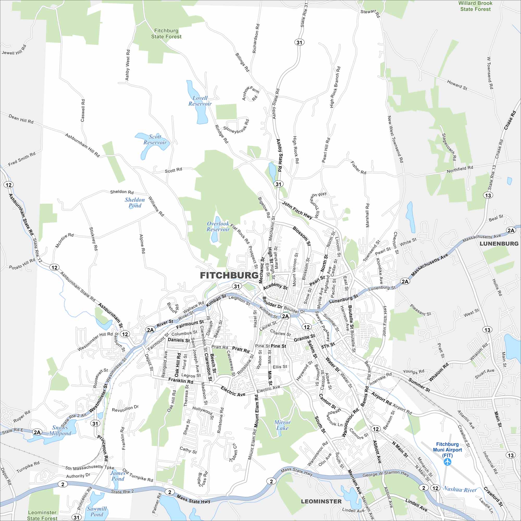
Fitchburg lies in north-central Massachusetts among rolling hills. The Nashua River runs right through the city. On our map, its ponds and small lakes stands out against the hilly backdrop.
Map Information
On the Map
Interstates/Highways: State Rte 2, State Rte 12, State Rte 31, State Rte 2A, State Rte 13, John Fitch Hwy Major Roads: Main St, Lunenburg St, Water St, River St, Westminster St, Ashburnham St, Electric Ave, Boulder Dr, Bemis Rd, Rindge Rd, Ashby State Rd, Richardson Rd, North St, Mechanic St, Airport Rd, Wanoosnoc Rd, Merriam Ave, Abbott Ave, Prospect St Airports: Fitchburg Muni Airport (FIT) Lakes and Reservoirs: Overlook Reservoir, Lovell Reservoir, Scott Reservoir, Mirror Lake, Snows Millpond, James Pond, Sawmill Pond Major Rivers: Nashua River Parks and Preserves: Fitchburg State Forest, Willard Brook State Forest, Leominster State Forest Nearby Communities: Leominster, LunenburgMassachusetts State Maps
Here’s our state maps of Massachusetts


City Maps of Massachusetts
Explore Boston and other urban areas in Massachusetts


