Map of Forest Lake, Minnesota
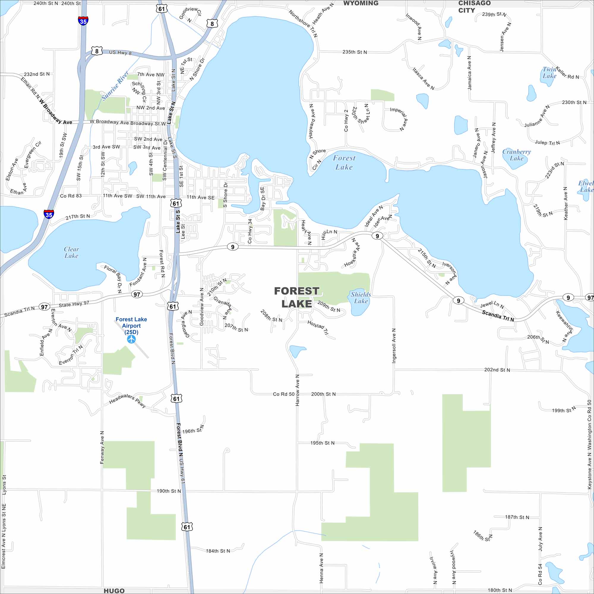
Forest Lake is shaped like a square and sits north of St. Paul. Its namesake lake is front and center but other smaller lakes are here too. Check out our map that includes streets, lakes and parks.
Map Information
On the Map
Interstates/Highways: I-35, US Hwy 8, State Rte 61, State Rte 97 Major Roads: Broadway Ave, Forest Blvd, Lake St, 11th Ave, 209th Ave, 210th Ave, 190th St, 200th St, 235th St, 240th St, Fenway Ave, Everton Ave, Scandia Trl, Goodview Ave, Itasca Ave, Jamaica Ave, Keystone Ave, July Ave, Harrow Ave, Northshore Trl Airports: Forest Lake Airport (25D) Lakes and Reservoirs: Forest Lake, Clear Lake, Shields Lake, Cranberry Lake, Twin Lake Major Rivers: Sunrise River Nearby Communities: Wyoming, Chisago City, HugoMinnesota State Maps
Explore every lake in our state maps of Minnesota


Minnesota City Maps
Browse through our city maps of Minnesota


