Map of Forrest City, Arkansas
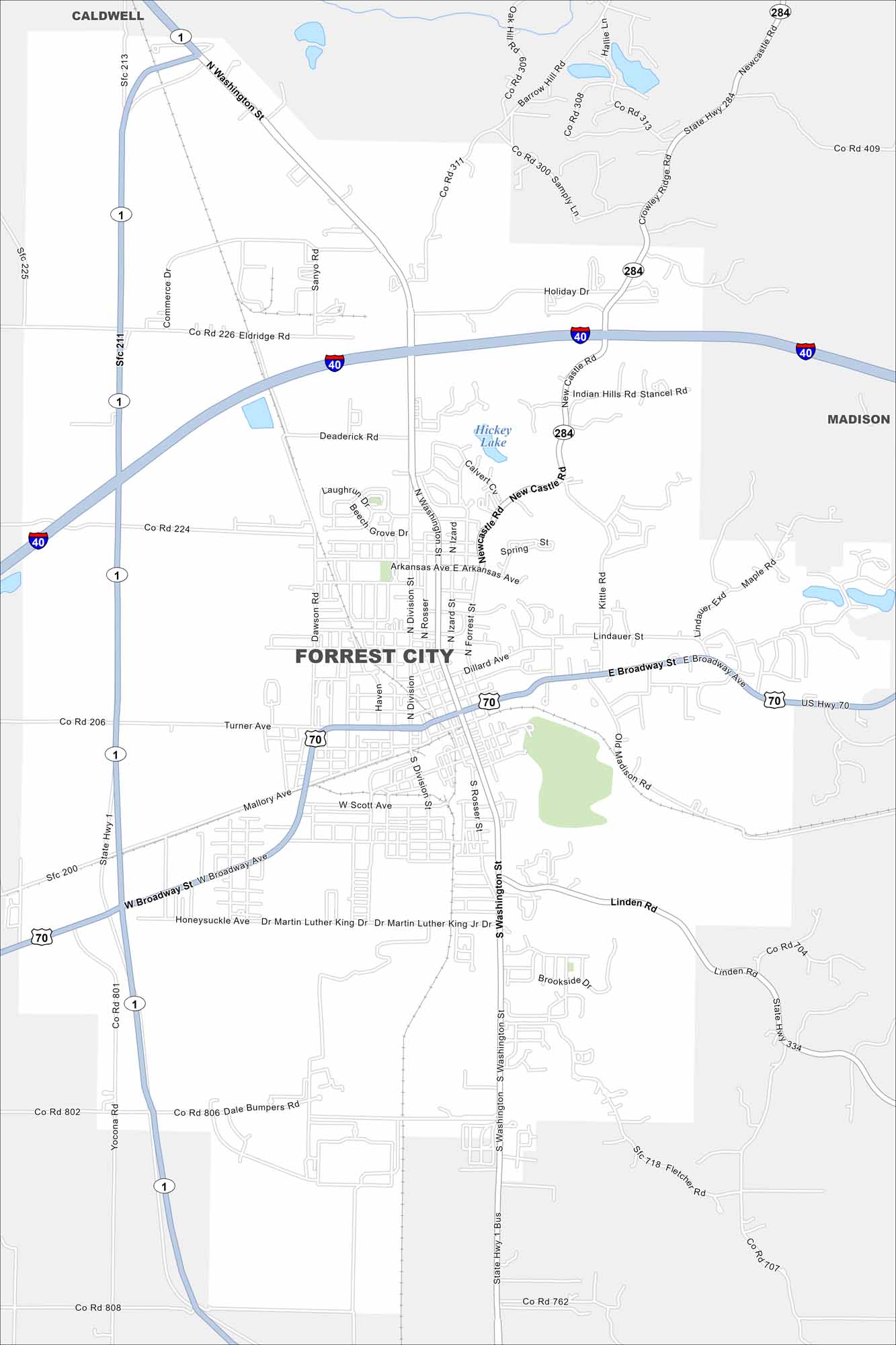
Check out our map of Forrest City in eastern Arkansas. The city lies along Crowley’s Ridge, which rises above the Delta flatlands.
Arkansas State Maps
Check out our Arkansas maps here


Map Information
On the Map
Interstates/Highways: I-40, US Hwy 70, State Hwy 1, State Hwy 284 Major Roads: Broadway Ave, Washington St, Division St, Rosser St, Izard St, Forrest St, Deaderick Rd, Dillard Ave, Turner Ave, Mallory Ave, Scott Ave, Linden Rd, Martin Luther King Jr Dr, New Castle Rd, Arkansas Ave, Eldridge Rd, Commerce Dr, Sanyo Rd, Dawson Rd, Kittle Rd Lakes and Reservoirs: Hickey Lake Nearby Communities: Caldwell, MadisonArkansas City Maps
Discover Arkansas through our city maps


