Map of Fort Dodge, Iowa
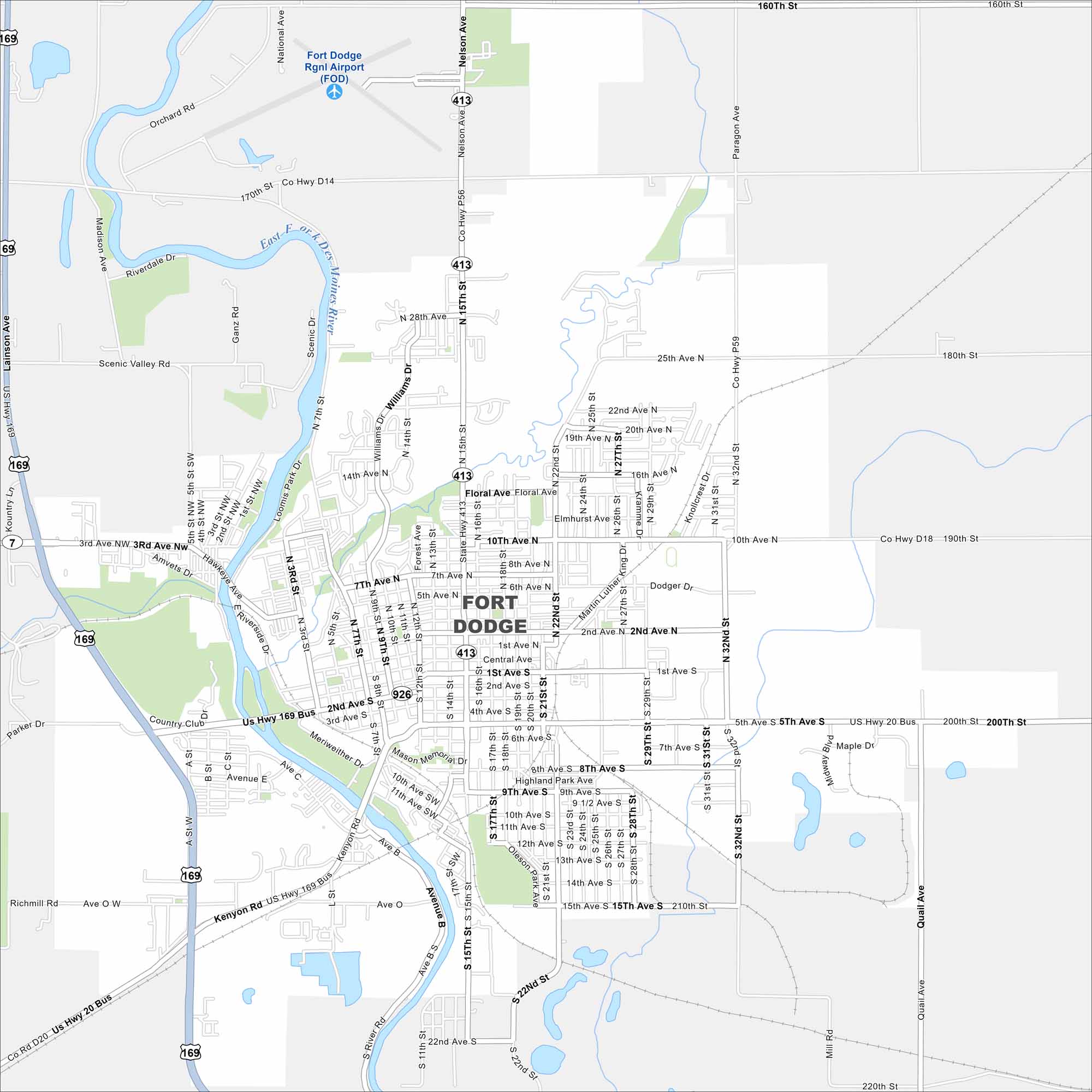
Our map of Fort Dodge highlights its spot along the Des Moines River. Our map includes rivers, lakes, highways and parks.


Map Information
On the Map
Interstates/Highways: US Hwy 20, US Hwy 169, US Hwy 20 Bus, US Hwy 169 Bus, State Rte 7 Major Roads: 2nd Ave N, 2nd Ave S, 5th Ave S, Central Ave, 1st Ave S, 15th St, 22nd St, 32nd St, 10th Ave N, 15th Ave S, Kenyon Rd, Nelson Ave, National Ave, Lainson Ave, Floral Ave, Madison Ave, Tower Dr, Quail Ave, 170th St, 190th St Airports: Fort Dodge Rgnl Airport (FOD) Major Rivers: Des Moines River Nearby Communities: North Fort DodgeIowa City Maps
Browse city maps in the state of Iowa


