Map of Fort Smith, Arkansas
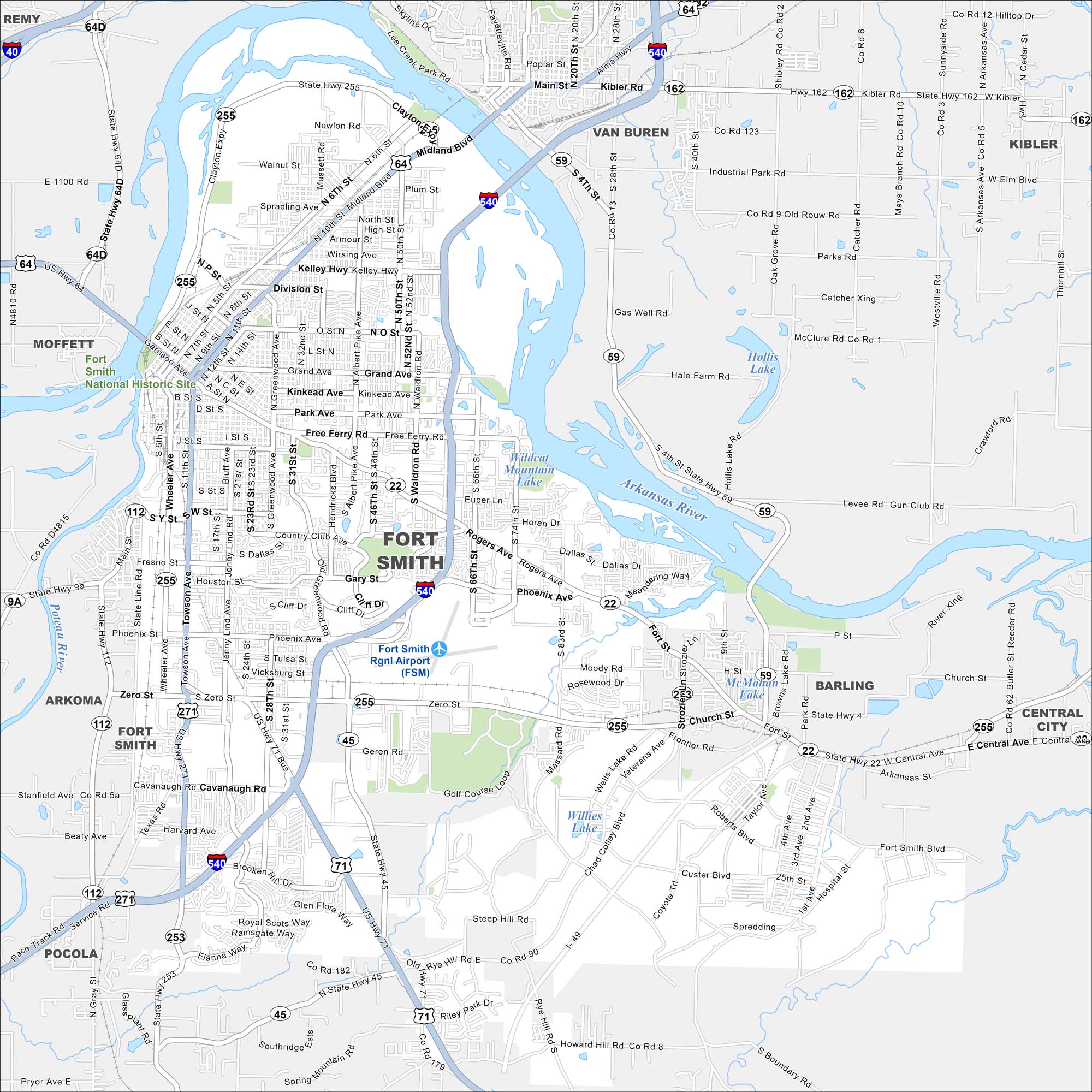
Fort Smith is on the Arkansas River, right by the Oklahoma border. The city spreads across rolling hills and flat river bottoms. Our map shows U.S. 64 and I-540, which connect the area.
Arkansas State Maps
Check out our Arkansas maps here


Map Information
On the Map
Interstates/Highways: I-540, I-40, US Hwy 71, US Hwy 64, US Hwy 271, State Hwy 255, State Hwy 22, State Hwy 45, State Hwy 59, State Hwy 112 Major Roads: Rogers Ave, Garrison Ave, Phoenix Ave, Zero St, Towson Ave, Waldron Rd, Kelly Hwy, Grand Ave, Midland Blvd, Wheeler Ave, Jenny Lind Rd, Massard Rd, Free Ferry Rd, Cavanaugh Rd, Geren Rd, Old Greenwood Rd, Dallas St, Kinkead Ave, Park Ave, Division St Airports: Fort Smith Rgnl Airport (FSM) Lakes and Reservoirs: Wildcat Mountain Lake, Hollis Lake, McMahan Lake, Willies Lake Major Rivers: Arkansas River, Poteau River Parks/Preserves/Forests: Fort Smith National Historic Site Nearby Communities: Van Buren, Barling, Arkoma, Moffett, Pocola, Central City, Kibler, RemyArkansas City Maps
Discover Arkansas through our city maps


