Map of Frisco, Texas
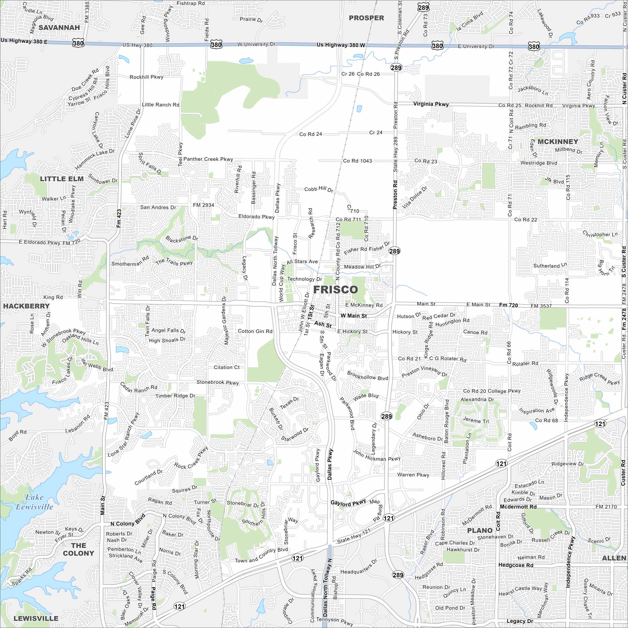
Check out our map of Frisco north of Dallas. It shows highways, lakes and rivers. Parks and open land fill in around the fast growth.
Map Information
On the Map
Interstates/Highways: State Rte 121, State Rte 289, US Hwy 380 Major Roads: Preston Rd, Main St, Dallas North Tollway, Legacy Dr, FM 423, Eldorado Pkwy, FM 720, FM 2934, FM 3537, FM 2478, Panther Creek Pkwy, Stonebrook Pkwy, Lebanon Rd, Rolater Rd, College Pkwy, Warren Pkwy, Gaylord Pkwy, Ohio Dr, Coit Rd, Independence Pkwy Lakes and Reservoirs: Lake Lewisville Nearby Communities: Frisco, Plano, McKinney, Allen, The Colony, Little Elm, Prosper, Savannah, HackberryTexas State Maps
Scan our maps of the massive southern state of Texas.


City Maps of Texas
Explore our map collection of Texas cities.


