Map of Garland, Texas
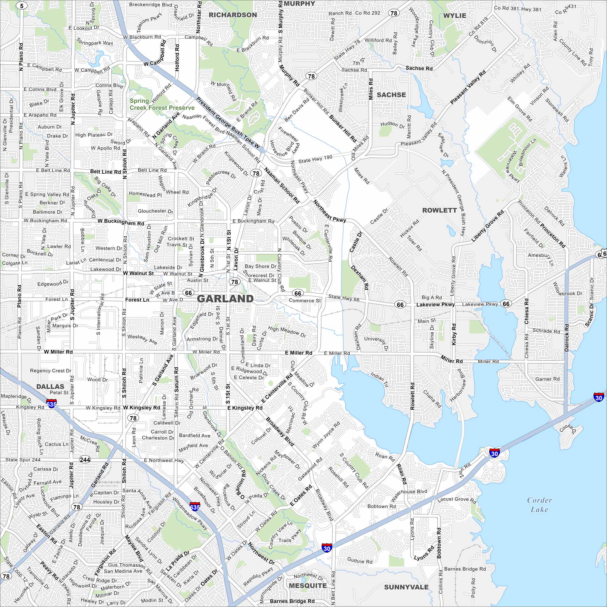
Our map of Garland shows its highways, streets, and open parks. Roads stretch wide here because the city is part of the Dallas-Fort Worth area. Garland is also known for its strong manufacturing roots.
Map Information
On the Map
Interstates/Highways: I-635, I-30, US Hwy 67, State Rte 78, State Rte 66, State Rte 244 Major Roads: Garland Rd, Miller Rd, Kingsley Rd, Buckingham Rd, Belt Line Rd, Apollo Rd, Walnut St, Forest Ln, Centerville Rd, Broadway Blvd, Northwest Hwy, Oates Dr, Shiloh Rd, Jupiter Rd, Plano Rd, First St, Lavon Dr, Rowlett Rd, Lakeview Pkwy, Collins Rd Lakes and Reservoirs: Corder Lake Nearby Communities: Rowlett, Sachse, Murphy, Richardson, Dallas, Mesquite, Sunnyvale, WylieTexas State Maps
Scan our maps of the massive southern state of Texas.


City Maps of Texas
Explore our map collection of Texas cities.


