Map of Gloucester, Massachusetts
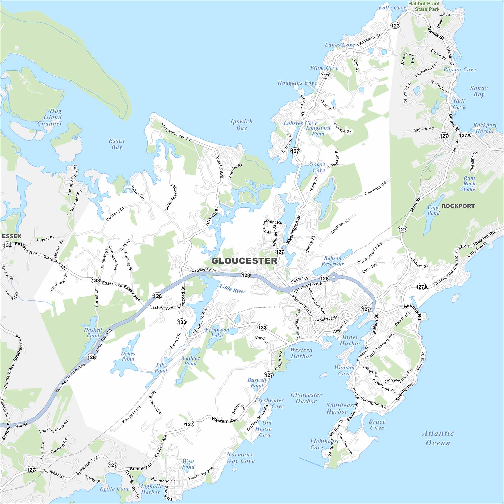
Gloucester sits on Cape Ann in Massachusetts, with a shoreline full of coves and beaches. It’s a working port but also a tourist draw. Ponds, reservoirs and harbors shape much of the map.
Map Information
On the Map
Interstates/Highways: State Rte 128, State Rte 127, State Rte 133, State Rte 127A Major Roads: Washington St, Western Ave, Eastern Ave, Main St, Essex Ave, Thatcher Rd, Atlantic Rd, Centennial Ave, Rogers St, Prospect St, Bass Ave, Atlantic St, Concord St, Magnolia Ave, Hesperus Ave, Bray St, Cherry St, Common Rd, Langsford St, Granite St Lakes and Reservoirs: Atlantic Ocean, Gloucester Harbor, Ipswich Bay, Essex Bay, Inner Harbor, Southeast Harbor, Sandy Bay, Rockport Harbor, Goose Cove, Lobster Cove, Hodgkins Cove, Plum Cove, Lanes Cove, Folly Cove, Babson Reservoir, Fernwood Lake, Wallace Pond, Lily Pond, Dykes Pond, Haskell Pond Major Rivers: Little River, Annisquam River Parks and Preserves: Halibut Point State Park Nearby Communities: Rockport, EssexMassachusetts State Maps
Here’s our state maps of Massachusetts


City Maps of Massachusetts
Explore Boston and other urban areas in Massachusetts


