Map of Greeley, Colorado
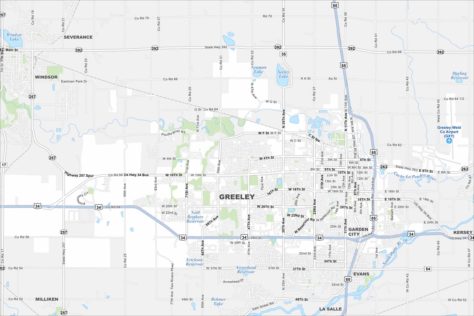
Check out our map of Greeley on the plains of northern Colorado. The Cache la Poudre River runs by the city. Farmland and open space surround the town. Our map shows its rivers, streets, green spaces and more.
Colorado State Maps
Browse Colorado with our detailed state maps


Map Information
On the Map
Interstates/Highways: US Hwy 34, US Hwy 85, State Hwy 257, State Hwy 392, State Hwy 54 Major Roads: 10th St, 20th St, 4th St, 16th St, 11th Ave, 8th Ave, 35th Ave, 47th Ave, 59th Ave, 71st Ave, 83rd Ave, 95th Ave, 13th St, 25th St, 28th St, 37th St, 49th St, O St, Eastman Park Dr, AA St Airports: Greeley-Weld Co Airport (GXY) Lakes and Reservoirs: Windsor Lake, Neuman Lake, Seeley Lake, Neill Brothers Reservoir, Erickson Reservoir, Arrowhead Reservoir, Rehmer Lake, Darling Reservoir Major Rivers: Poudre River, Cache La Poudre River, South Platte River Nearby Communities: Windsor, Severance, Garden City, Evans, La Salle, Kersey, MillikenColorado City Maps
Here are maps of Colorado’s urban areas


