Map of White Bear Lake, Minnesota
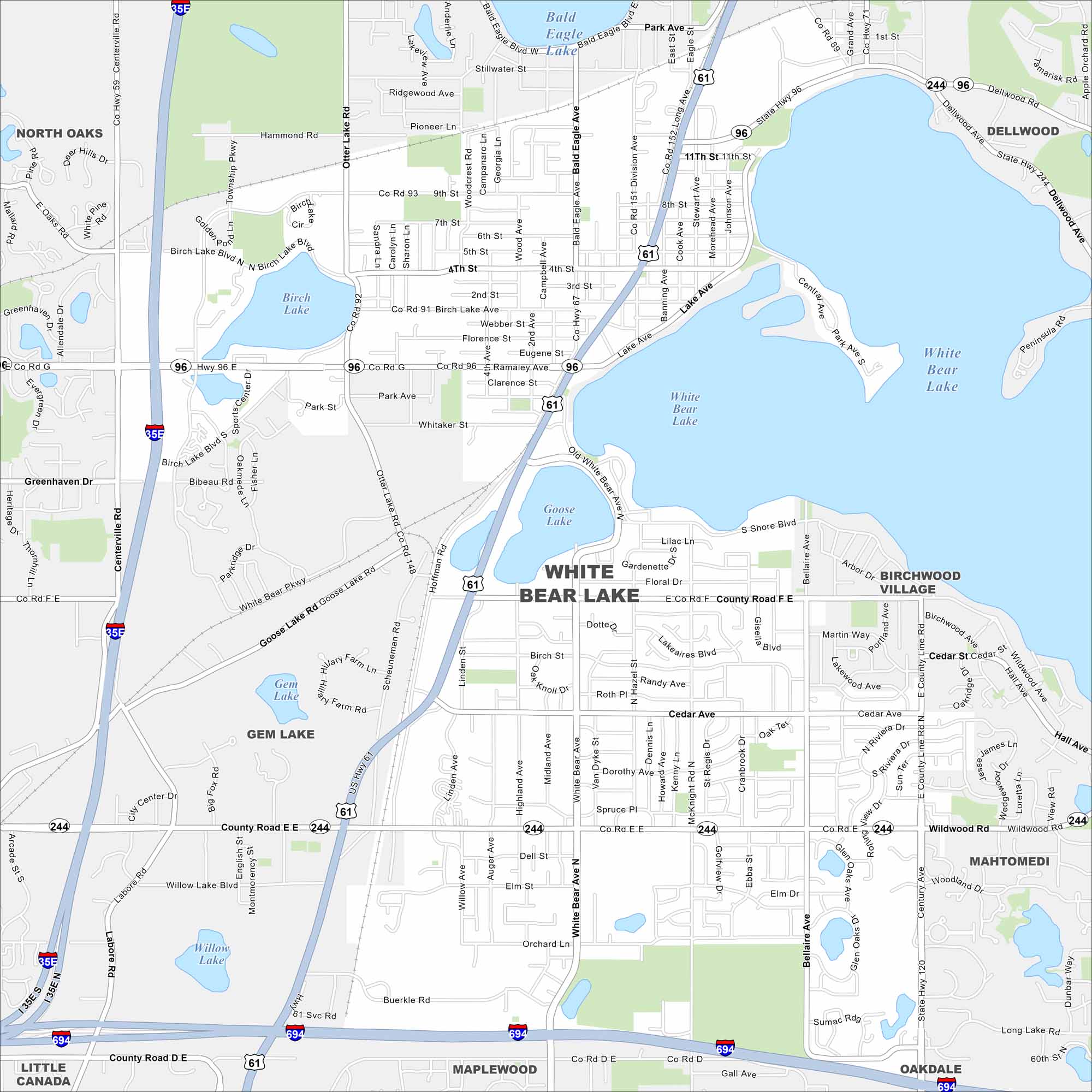
Need directions for White Bear Lake? This city north of St. Paul is named for its large lake, a favorite for boating and fishing. Our map includes all major lakes in the vicinity.
Map Information
On the Map
Interstates/Highways: I-35E, I-694, US Hwy 61, State Rte 96, State Rte 244 Major Roads: White Bear Ave, Buerkle Rd, County Rd E, County Rd F, Goose Lake Rd, Lake Ave, Stewart Ave, Birch Lake Blvd, Centerville Rd, Otter Lake Rd, 4th St, 11th St, Stillwater St, Cedar Ave, Spruce Pl, Orchard Ln, Sumac Rd, Whitaker St, Ramaley Ave, Bellaire Ave Lakes and Reservoirs: White Bear Lake, Birch Lake, Goose Lake, Gem Lake, Bald Eagle Lake, Willow Lake Nearby Communities: North Oaks, Dellwood, Birchwood Village, Mahtomedi, Gem Lake, Little Canada, Maplewood, OakdaleMinnesota State Maps
Explore every lake in our state maps of Minnesota


Minnesota City Maps
Browse through our city maps of Minnesota


