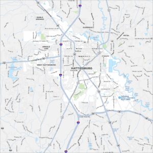
Map of Hattiesburg, Mississippi
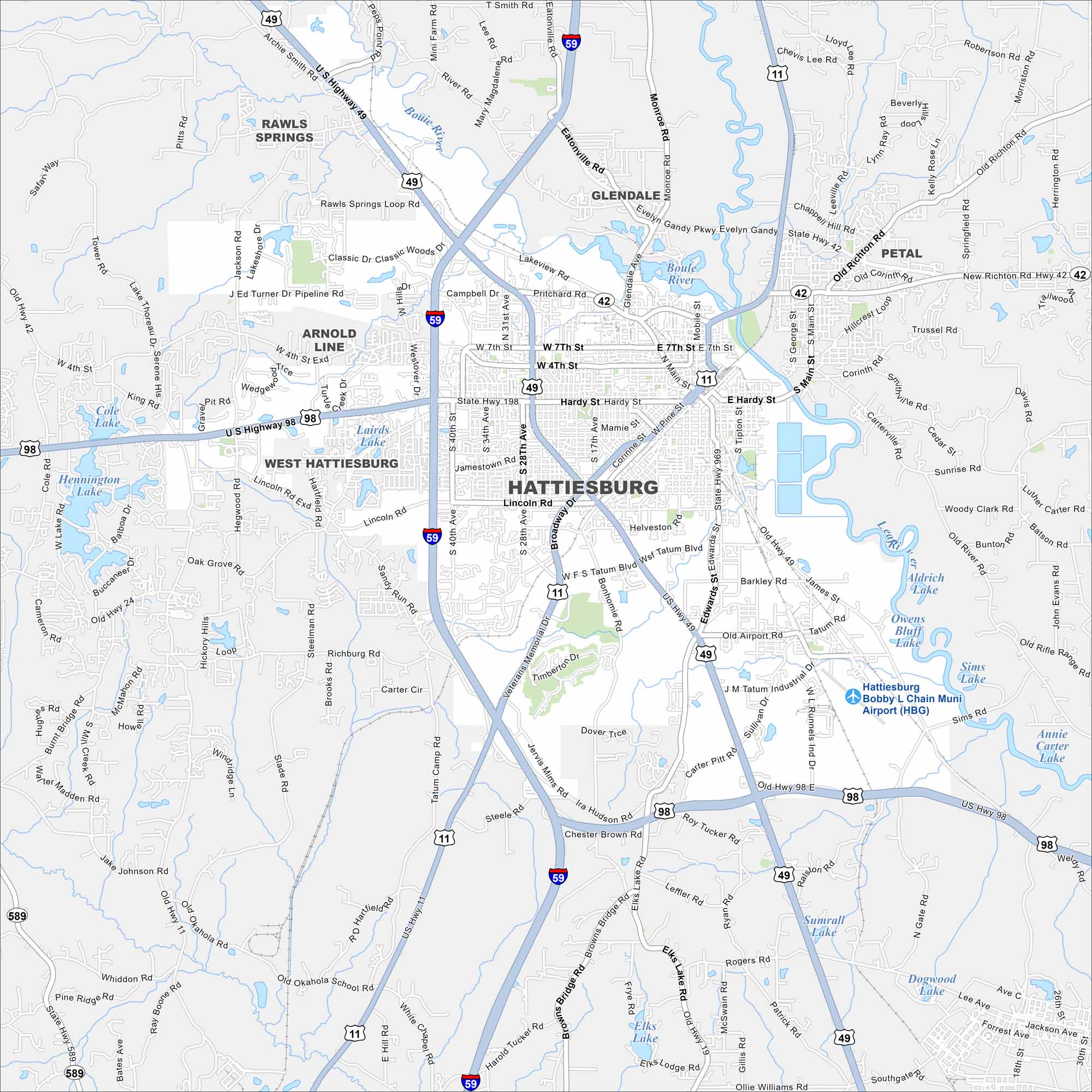
Hattiesburg is in southern Mississippi, not far from the Pine Belt forests. Highways converge here, making it a regional hub.
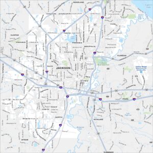
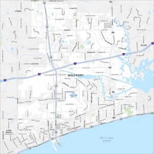
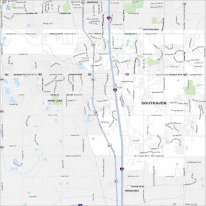
Map Information
On the Map
Interstates/Highways: I-59, US Hwy 49, US Hwy 98, US Hwy 11, State Hwy 42, State Hwy 198, State Hwy 24, State Hwy 589 Major Roads: Hardy St, Broadway Dr, Lincoln Rd, 28th Ave, 40th Ave, 31st Ave, Veterans Memorial Dr, Westover Dr, Main St, Edwards St, Mamie St, Corinne St, James St, Tatum Rd, Sullivan Dr, Ralston Rd, Elks Lake Rd, Old Hwy 11, Richburg Rd, Oak Grove Rd Airports: Hattiesburg Bobby L Chain Muni Airport (HBG) Lakes and Reservoirs: Cole Lake, Lairds Lake, Hennington Lake, Aldrich Lake, Owens Bluff Lake, Sims Lake, Annie Carter Lake, Elks Lake, Sumrall Lake, Dogwood Lake Nearby Communities: Rawls Springs, Glendale, Petal, Arnold Line, West HattiesburgMississippi State Maps
Explore maps of Mississippi’s towns, rivers, and roads.


Mississippi City Maps
Discover Mississippi with our city maps