Map of Haverhill, Massachusetts
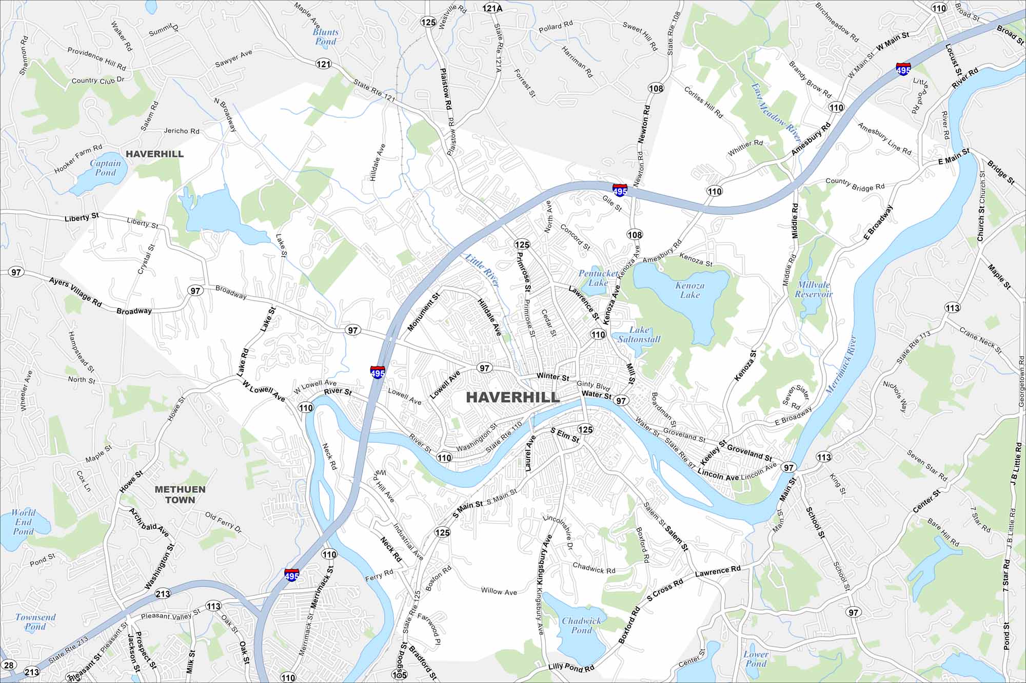
Explore our map of Haverhill along the Merrimack River in northeastern Massachusetts. The city runs right up to the New Hampshire border. The river so strongly shapes its layout, you’ll see bridges crossing at key points.
Map Information
On the Map
Interstates/Highways: I-495, State Rte 125, State Rte 97, State Rte 110, State Rte 113, State Rte 121, State Rte 108, State Rte 121A Major Roads: Broadway, Main St, River St, Water St, Amesbury Rd, Primrose St, Lowell Ave, Hilldale Ave, Washington St, Kenoza Ave, Lincoln Ave, Groveland St, North Ave, Winter St, S Elm St, Cedar St, Lawrence St, Mill St, Boardman St, Keeley St Lakes and Reservoirs: Kenoza Lake, Lake Saltonstall, Millvale Reservoir, Crystal Lake, Captain Pond, Blunts Pond, Chadwick Pond, Johnson Pond, Lower Pond Major Rivers: Merrimack River, Little River Nearby Communities: Methuen Town, Haverhill, BradfordMassachusetts State Maps
Here’s our state maps of Massachusetts


City Maps of Massachusetts
Explore Boston and other urban areas in Massachusetts


