Map of Holyoke, Massachusetts
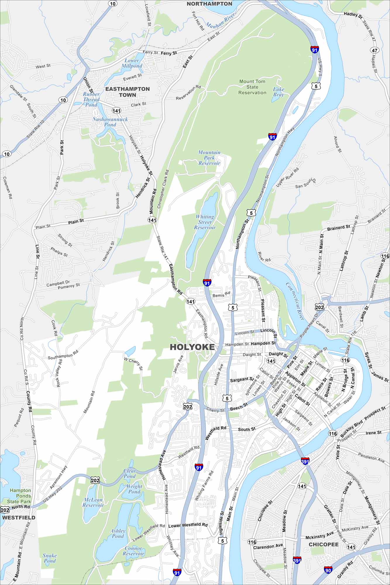
Explore our map of Holyoke by the Connecticut River. Old mill buildings line the water. The Mount Tom Range rises just to the northwest.
Map Information
On the Map
Interstates/Highways: I-91, I-391, I-90, US Hwy 5, US Hwy 202, State Rte 141, State Rte 116, State Rte 10, State Rte 47 Major Roads: Main St, Dwight St, Northampton Hwy, Easthampton Rd, Homestead Ave, Holyoke St, Cherry St, Beech St, Appleton St, Cabot St, Sargeant St, Westfield Rd, Whiting Farms Rd, Lower Westfield Rd, Pleasant St, Lincoln St, Hampden St, High St, Maple St, Race St Lakes and Reservoirs: Whiting Street Reservoir, Mountain Park Reservoir, Ashley Pond, McLean Reservoir, Wright Pond, Clear Pond, Lower Millpond, Nashawannuck Pond, Rubber Thread Pond, Connor Reservoir, Lake Bray Major Rivers: Connecticut River, Manhan River Parks and Preserves: Mount Tom State Reservation, Hampton Ponds State Park Nearby Communities: Easthampton Town, Chicopee, Northampton, WestfieldMassachusetts State Maps
Here’s our state maps of Massachusetts


City Maps of Massachusetts
Explore Boston and other urban areas in Massachusetts


