Map of Huntsville, Texas
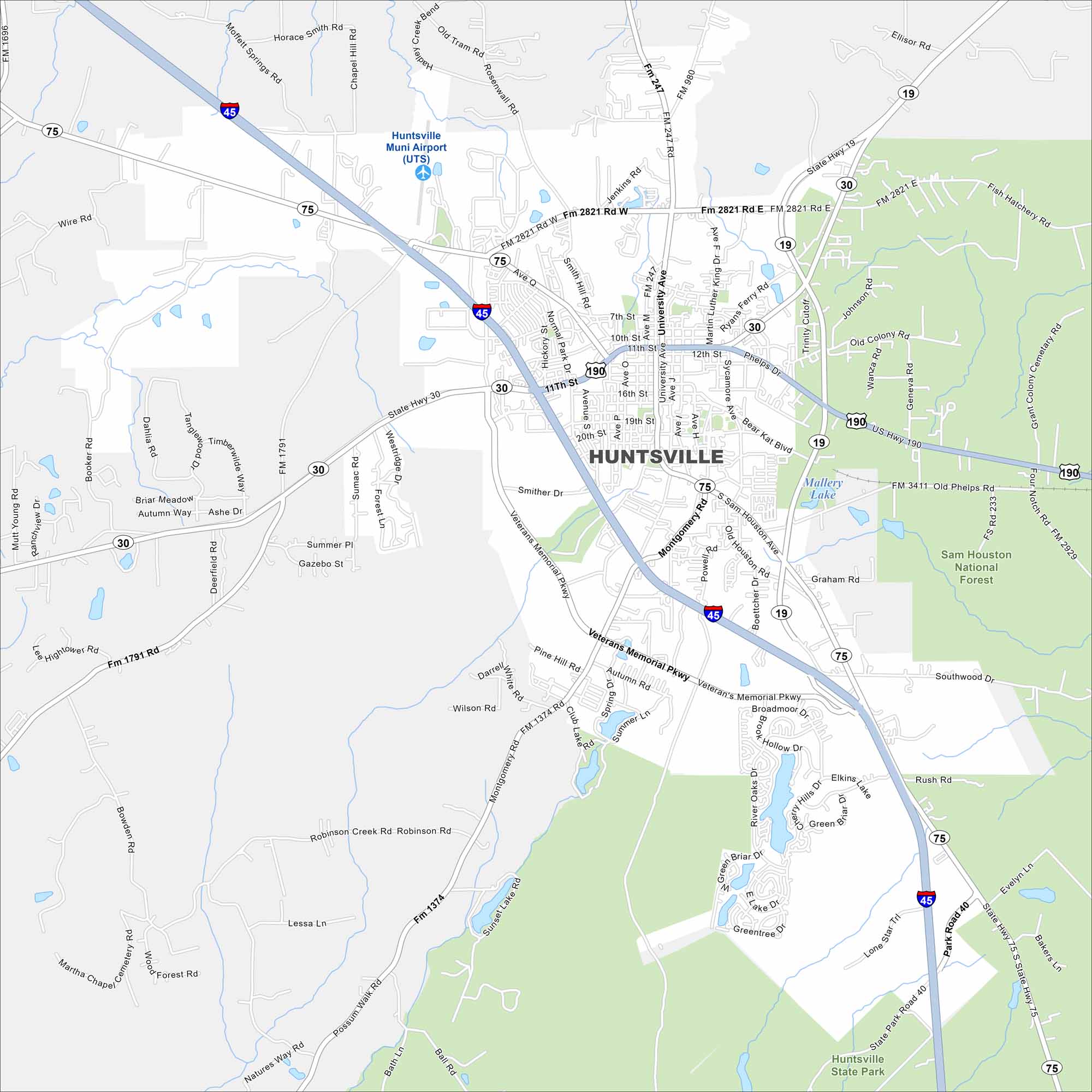
Get to know Huntsville north of Houston. Our map shows highways, roads, rivers, lakes and state parks. Sam Houston State University and the prison complex are main features here.
Map Information
On the Map
Interstates/Highways: I-45, US Hwy 190, State Hwy 30, State Hwy 75, State Hwy 19 Major Roads: Veterans Memorial Pkwy, Sam Houston Ave, Montgomery Rd, University Ave, 11th St, Normal Park Dr, 19th St, Smither Dr, Pine Hill Rd, Robinson Rd, Possum Walk Rd, Bowden Rd, Booker Rd, Old Phelps Rd, Ellisor Rd, 22nd St, Avenue O, Avenue M Airports: Huntsville Muni Airport (UTS) Lakes and Reservoirs: Lake Raven, Mallery Lake Parks and Preserves: Sam Houston National Forest, Huntsville State ParkTexas State Maps
Scan our maps of the massive southern state of Texas.


City Maps of Texas
Explore our map collection of Texas cities.


