Map of Irving, Texas
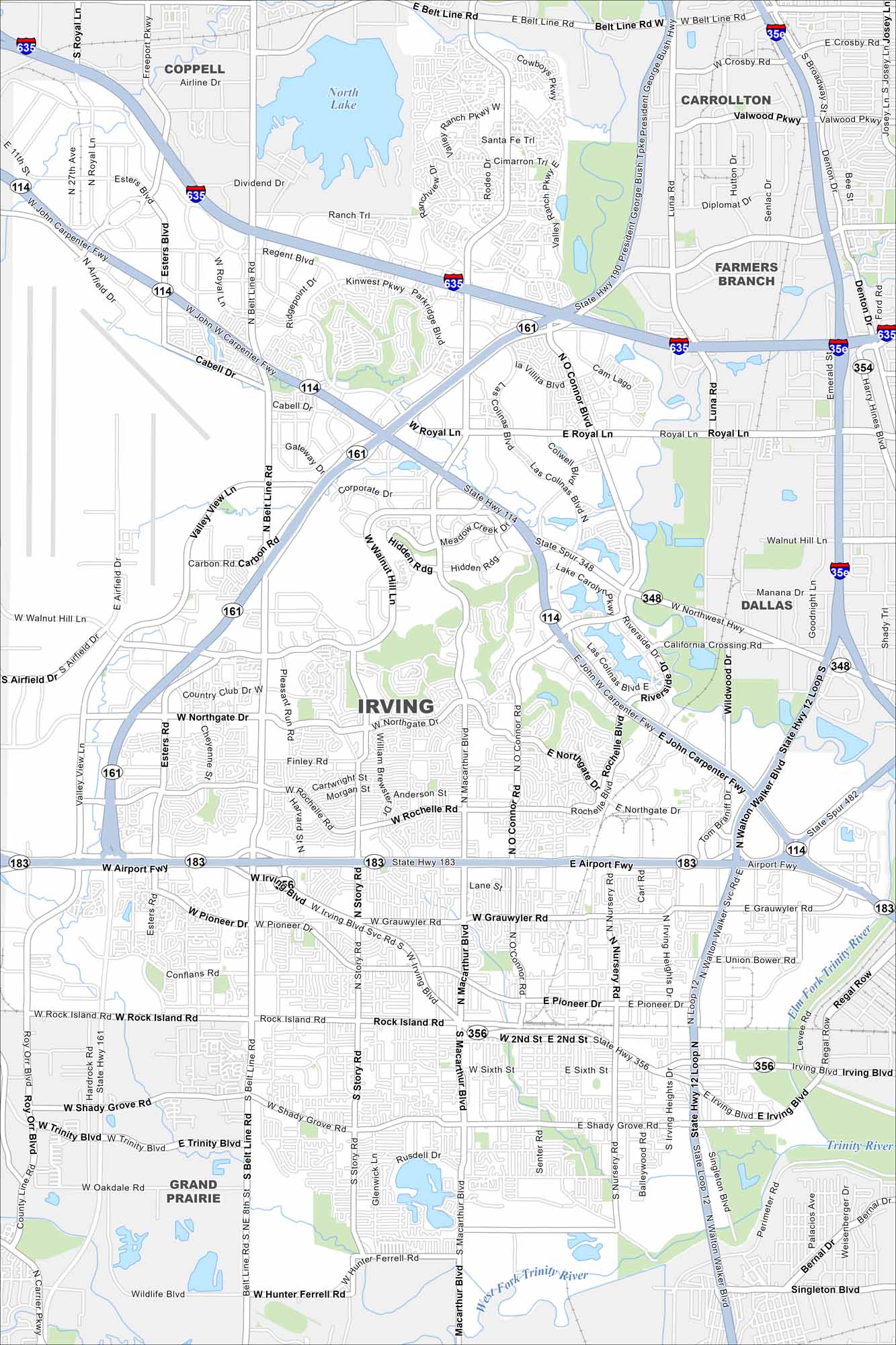
Our map of Irving shows its position between Dallas and Fort Worth. The Trinity River bends across the southern edge. Las Colinas and its lakes mark the heart of the city.
Map Information
On the Map
Interstates/Highways: I-635, State Hwy 114, State Hwy 161, State Hwy 183, State Hwy 348, State Hwy 356, State Spur 348, State Spur 482 Major Roads: Belt Line Rd, MacArthur Blvd, O’Connor Rd, Story Rd, Irving Blvd, Northgate Dr, Rochelle Rd, Airport Fwy, Pioneer Dr, Grauwyler Rd, Shady Grove Rd, Walnut Hill Ln, Royal Ln, Valley View Ln, Carbon Rd, Esters Rd, Freeport Pkwy, Las Colinas Blvd, Riverside Dr, Singleton Blvd Lakes and Reservoirs: North Lake, Lake Carolyn Major Rivers: Elm Fork Trinity River, West Fork Trinity River Nearby Communities: Coppell, Carrollton, Farmers Branch, Dallas, Grand PrairieTexas State Maps
Scan our maps of the massive southern state of Texas.


City Maps of Texas
Explore our map collection of Texas cities.


