Map of Laredo, Texas
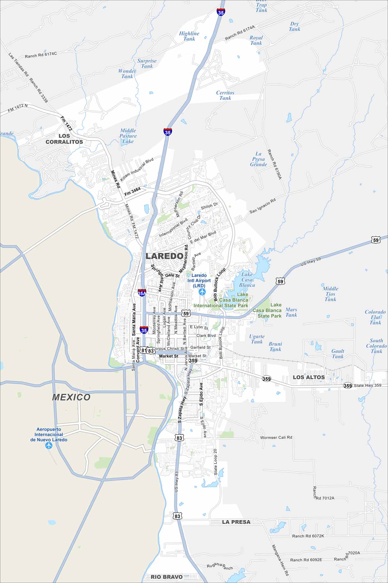
Our map shows Laredo lining up along the border, right on the Rio Grande. Bridges cross into Mexico on the map. Interstate 35 heads north toward San Antonio.
Map Information
On the Map
Interstates/Highways: I-35, US Hwy 59, US Hwy 83, State Rte 359, State Rte 20 Major Roads: San Bernardo Ave, Santa Maria Ave, Convent Ave, McPherson Rd, Bob Bullock Loop, International Blvd, Saunders St, Clark Blvd, Lyon St, Market St, Corpus Christi St, Guadalupe St, Ejido Ave, Zapata Hwy, Mines Rd, Killam Industrial Blvd, Shiloh Dr, Del Mar Blvd, Springfield Ave, Bartlett Ave Airports: Laredo Intl Airport (LRD), Aeropuerto Internacional de Nuevo Laredo Lakes and Reservoirs: Lake Casa Blanca, Middle Pasture Lake, Surprise Tank, Wonder Tank, Highline Tank, Royal Tank, Dry Tank, Trap Tank, Cerritos Tank, La Presa Grande, Bruni Tank, Ugarte Tank, Gault Tank Major Rivers: Rio Grande Parks and Preserves: Lake Casa Blanca International State Park Nearby Communities: Los Corralitos, Mexico, Los Altos, La Presa, Rio BravoTexas State Maps
Scan our maps of the massive southern state of Texas.


City Maps of Texas
Explore our map collection of Texas cities.


