Map of Leominster, Massachusetts
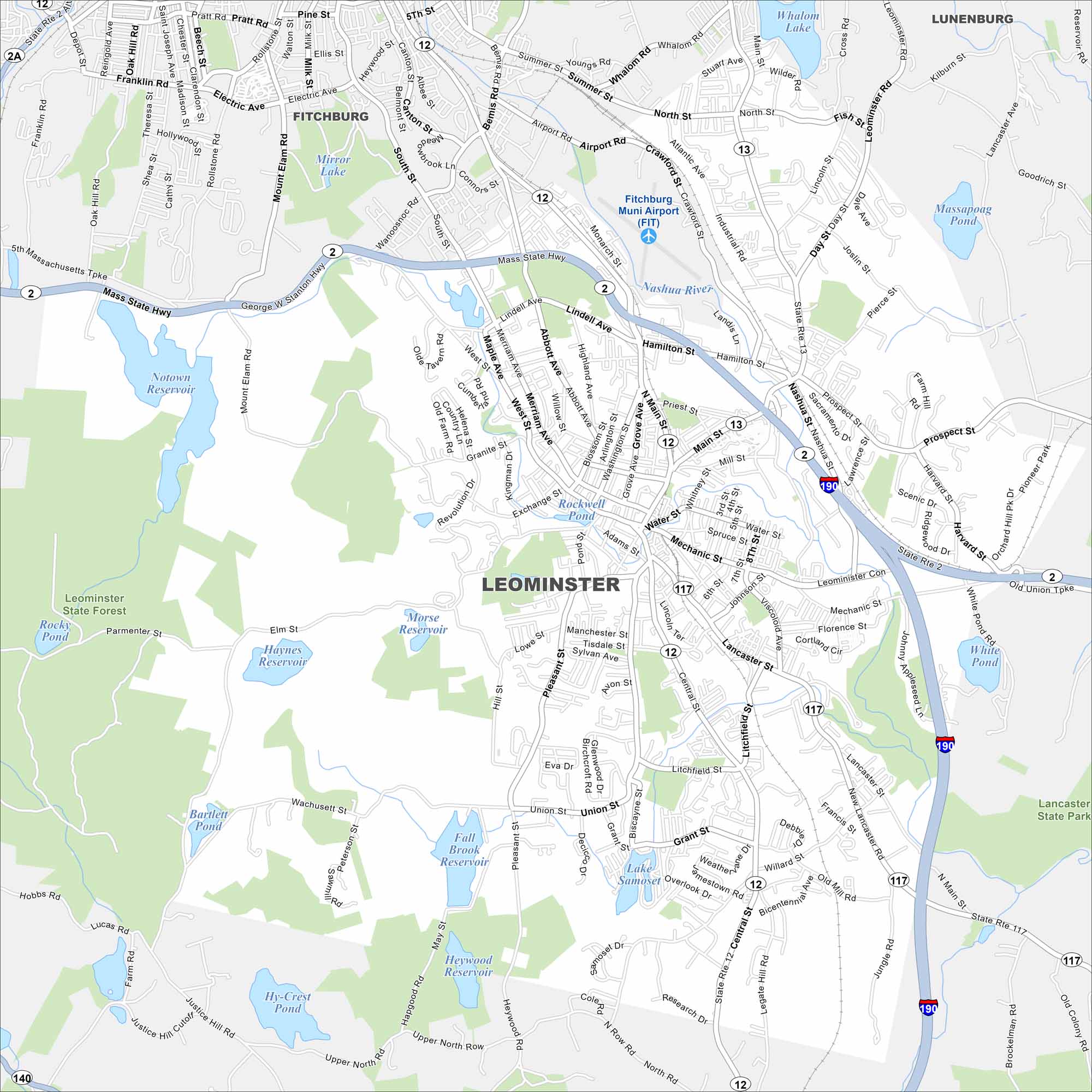
Our map of Leominster shows the city nestled among rolling hills in north-central Massachusetts. The Monoosnoc Brook runs right through town. Neighborhoods branch outward from its compact center.
Map Information
On the Map
Interstates/Highways: I-190, State Rte 2, State Rte 12, State Rte 13, State Rte 117 Major Roads: Main St, Central St, N Main St, Lancaster St, Mechanic St, Merriam Ave, Pleasant St, Haws St, Union St, West St, Lindell Ave, Airport Rd, Prospect St, Willard St, Jungle Rd, Nashua St, Water St, Whitney St, Spruce St, 8th St Airports: Fitchburg Muni Airport (FIT) Lakes and Reservoirs: Notown Reservoir, Morse Reservoir, Rockwell Pond, Fall Brook Reservoir, Haynes Reservoir, Lake Samoset, White Pond, Hy-Crest Pond, Bartlett Pond, Massapoag Pond, Whalom Lake, Mirror Lake Major Rivers: Nashua River Parks and Preserves: Leominster State Forest, Lancaster State Park Nearby Communities: Fitchburg, LunenburgMassachusetts State Maps
Here’s our state maps of Massachusetts


City Maps of Massachusetts
Explore Boston and other urban areas in Massachusetts


