Map of Lewisville, Texas
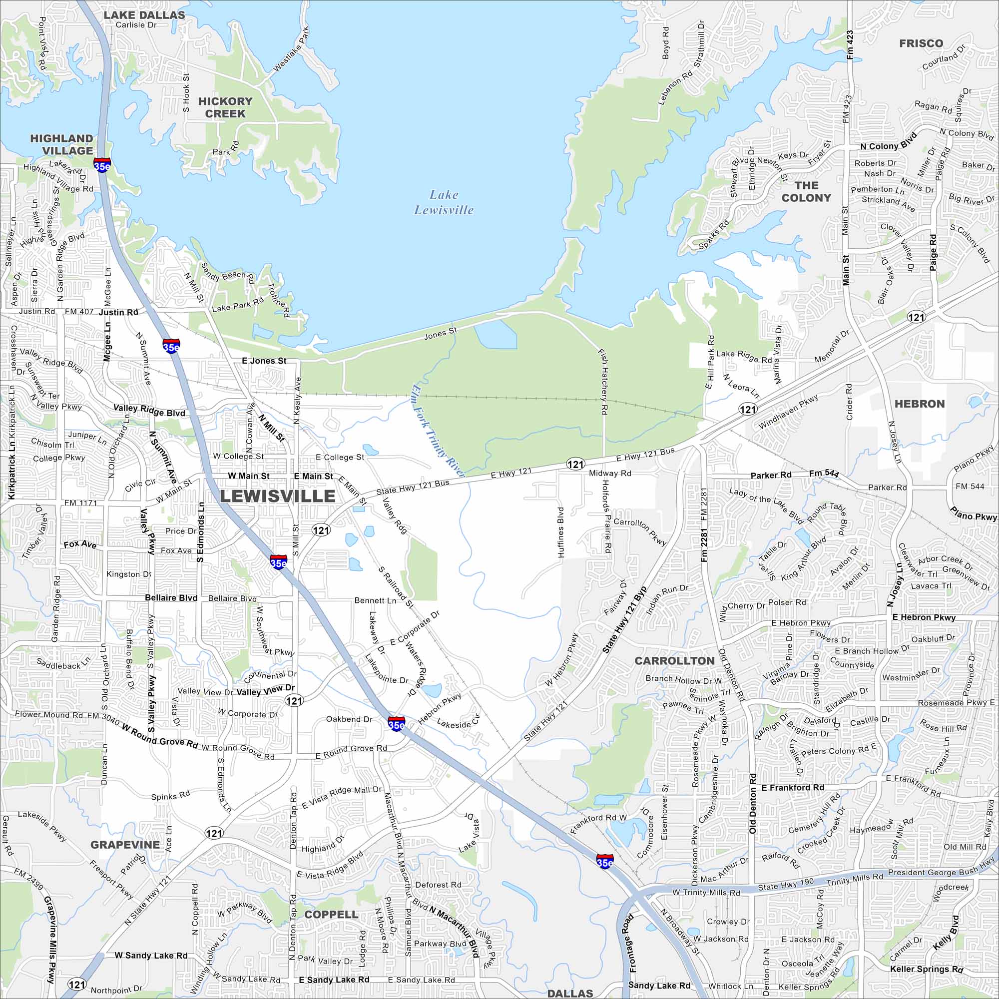
Our map of Lewisville highlights the vast Lewisville Lake to the north. Residential areas spread outward in every direction. The city sort of mixes into the Dallas-Fort Worth metro to the south.
Map Information
On the Map
Interstates/Highways: I-35E, State Hwy 121, State Hwy 190 Major Roads: Main St, Round Grove Rd, Corporate Dr, Valley Ridge Blvd, College Pkwy, Justin Rd, Mill St, Edmonds Ln, Fox Ave, Bellaire Blvd, Spinks Rd, Garden Ridge Blvd, Lake Park Rd, Hebron Pkwy, Frankford Rd, Sandy Lake Rd, McArthur Blvd, President George Bush Hwy, Josey Ln, Old Denton Rd Lakes and Reservoirs: Lake Lewisville Major Rivers: Elm Fork Trinity River Nearby Communities: Highland Village, Hickory Creek, Lake Dallas, The Colony, Frisco, Hebron, Carrollton, Coppell, Grapevine, DallasTexas State Maps
Scan our maps of the massive southern state of Texas.


City Maps of Texas
Explore our map collection of Texas cities.


