Map of Windsor, Colorado
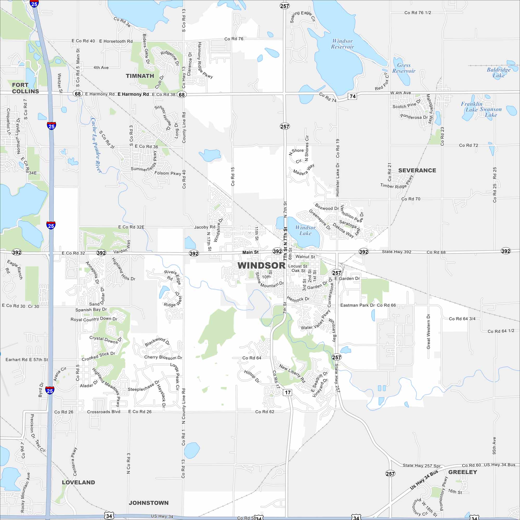
Check out Windsor, a town situated between Fort Collins and Greeley. Our map shows local streets and main routes like Interstate 25.
Colorado State Maps
Browse Colorado with our detailed state maps


Map Information
On the Map
Interstates/Highways: I-25, US Hwy 34, State Hwy 392, State Hwy 257, State Hwy 68 Major Roads: Main St, 7th St, Crossroads Blvd, Harmony Rd, Carpenter Rd, 11th St, 15th St, Hollister Lake Rd, County Line Rd, Weld County Rd 13, Weld County Rd 15, Weld County Rd 23, Weld County Rd 17, Jacoby Rd, New Liberty Rd, Eastman Park Dr, Littel Dr, Garden Dr, Locust St, Walnut St Lakes and Reservoirs: Windsor Lake, Windsor Reservoir, Gress Reservoir, Baldridge Lake, Franklin Lake, Swanson Lake, Kyger Reservoir, Fossil Creek Reservoir, Kern Reservoir Major Rivers: Cache La Poudre River Nearby Communities: Fort Collins, Timnath, Severance, Greeley, Loveland, JohnstownColorado City Maps
Here are maps of Colorado’s urban areas


