Map of Little Rock, Arkansas
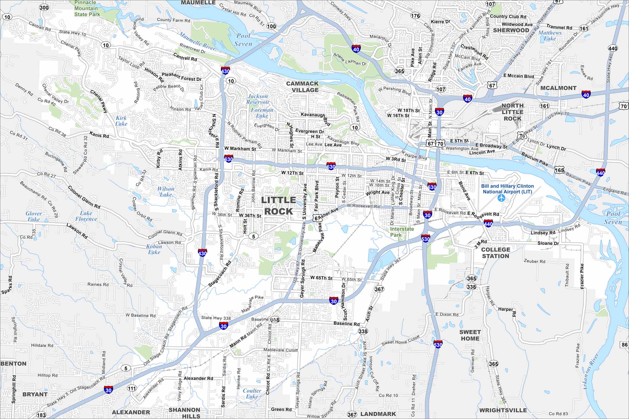
Our map of Little Rock shows the Arkansas River running through downtown. Interstates 30 and 40 cross near the city. The state capitol and River Market area mark its core.
Arkansas State Maps
Check out our Arkansas maps here


Map Information
On the Map
Interstates/Highways: I-30, I-40, I-430, I-440, I-530, I-630, US Hwy 65, US Hwy 67, US Hwy 167, US Hwy 70, State Hwy 10, State Hwy 300, State Hwy 365, State Hwy 367 Major Roads: Chenal Pky, Financial Centre Pky, Cantrell Rd, University Ave, Broadway St, Asher Ave, Colonel Glenn Rd, Roosevelt Rd, Geyer Springs Rd, La Harpe Blvd, Stagecoach Rd, 65th St, Arch St, Springer Blvd, Dixon Rd, Cumberland St, College St, Confederate Blvd, 2nd St, 9th St Airports: Bill and Hillary Clinton National Airport (LIT) Lakes and Reservoirs: Pool Seven, Jackson Reservoir, Matthews Lake, Wilson Lake Major Rivers: Arkansas River Parks/Preserves/Forests: Pinnacle Mountain State Park Nearby Communities: North Little Rock, Maumelle, Jacksonville, Sherwood, Benton, Bryant, Alexander, Shannon Hills, Cammack Village, Wrightsville, College Station, Landmark, McAlmont, Natural Steps, Salem, Sweet HomeArkansas City Maps
Discover Arkansas through our city maps


