Map of Live Oak, Texas
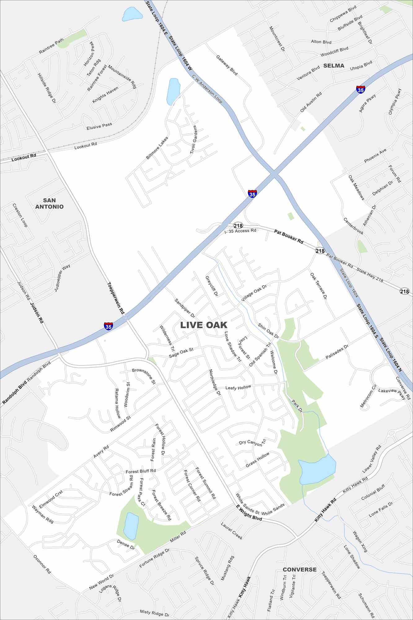
Explore Live Oak northeast of San Antonio. Our map shows I-35 and Loop 1604 meeting near the city. Retail centers and neighborhoods spread around the crossroads.
Map Information
On the Map
Interstates/Highways: I-35, State Loop 1604, State Hwy 218 Major Roads: Pat Booker Rd, Judson Rd, Topperwein Rd, Lookout Rd, Randolph Blvd, O’Connor Rd, Miller Rd, Kitty Hawk, Shin Oak Dr, Village Oak Dr, Welcome Dr, Leafy Hollow, Forest Bluff Rd, Fortune Ridge Dr, Mustang Rd, Weidner Rd, Forum Rd, Agora Pkwy, Olympia Pkwy, Centerbrook Nearby Communities: San Antonio, Selma, ConverseTexas State Maps
Scan our maps of the massive southern state of Texas.


City Maps of Texas
Explore our map collection of Texas cities.


