Map of Maplewood, Minnesota
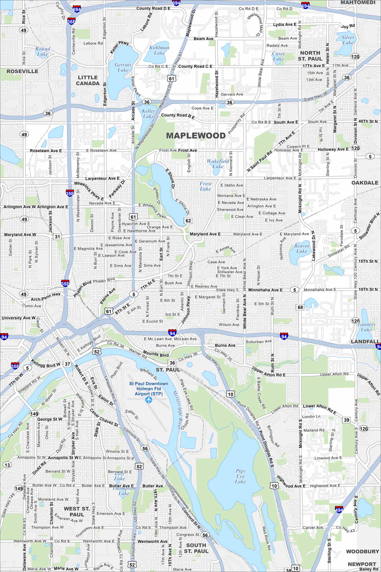
Explore Maplewood with our map. Highways form key routes around its neighborhoods and parks. Lakes and green spaces are scattered around the city. It sits right next to St. Paul, Minnesota.
Map Information
On the Map
Interstates/Highways: I-694, I-35E, I-94, I-494, US Hwy 61, US Hwy 10, State Rte 36, State Rte 5, State Rte 120 Major Roads: Larpenteur Ave, White Bear Ave, Maryland Ave, Minnehaha Ave, McKnight Rd, Beam Ave, Frost Ave, Roselawn Ave, 7th St, Stillwater Rd, Lower Afton Rd, Upper Afton Rd, Century Ave, Robert St, Wabasha St, Concord St, 3rd St, Arcade St, Edgerton St, Rice St Airports: St Paul Downtown Holman Fld Airport (STP) Lakes and Reservoirs: Kohlman Lake, Gervais Lake, Keller Lake, Phalen Lake, Round Lake, Casey Lake, Silver Lake, Tanners Lake, Pigs Eye Lake, Thompson Lake, Beaver Lake, Wakefield Lake, Frost Lake Major Rivers: Mississippi River Nearby Communities: Roseville, Little Canada, North St Paul, Mahtomedi, Oakdale, Landfall, Woodbury, Newport, South St Paul, West St Paul, St PaulMinnesota State Maps
Explore every lake in our state maps of Minnesota


Minnesota City Maps
Browse through our city maps of Minnesota


