Map of McAllen, Texas
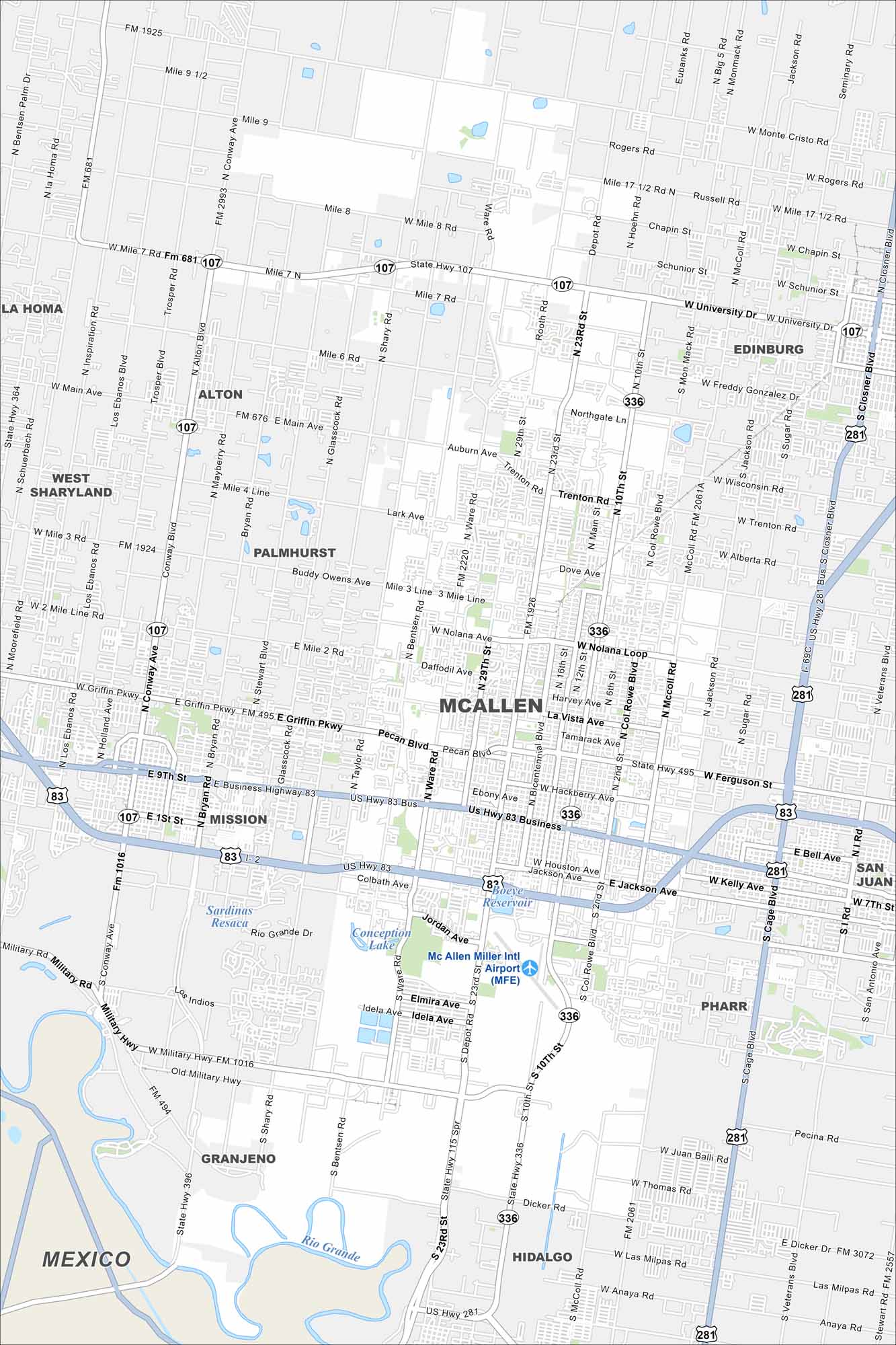
McAllen sits in the Rio Grande Valley near the Mexican border. Our map shows its main roads, airport, lakes and rivers.
Map Information
On the Map
Interstates/Highways: I-2, I-69C, US Hwy 83, State Rte 107, State Rte 336, State Rte 495 Major Roads: University Dr, Nolana Ave, 10th St, 23rd St, Main St, Bentsen Rd, Ware Rd, Taylor Rd, Shary Rd, Conway Ave, Pecan Blvd, Griffin Pkwy, Business 83, Military Hwy, Mile 3 Rd, Mile 10 Rd, Monte Cristo Rd, Dicker Rd, Stewart Rd, Glasscock Rd Airports: McAllen Miller Intl Airport (MFE) Lakes and Reservoirs: Boeye Reservoir, Conception Lake Major Rivers: Rio Grande Nearby Communities: Edinburg, Mission, Pharr, Hidalgo, Alton, Palmhurst, San Juan, Granjeno, La Homa, MexicoTexas State Maps
Scan our maps of the massive southern state of Texas.


City Maps of Texas
Explore our map collection of Texas cities.


