Map of Meridian, Mississippi
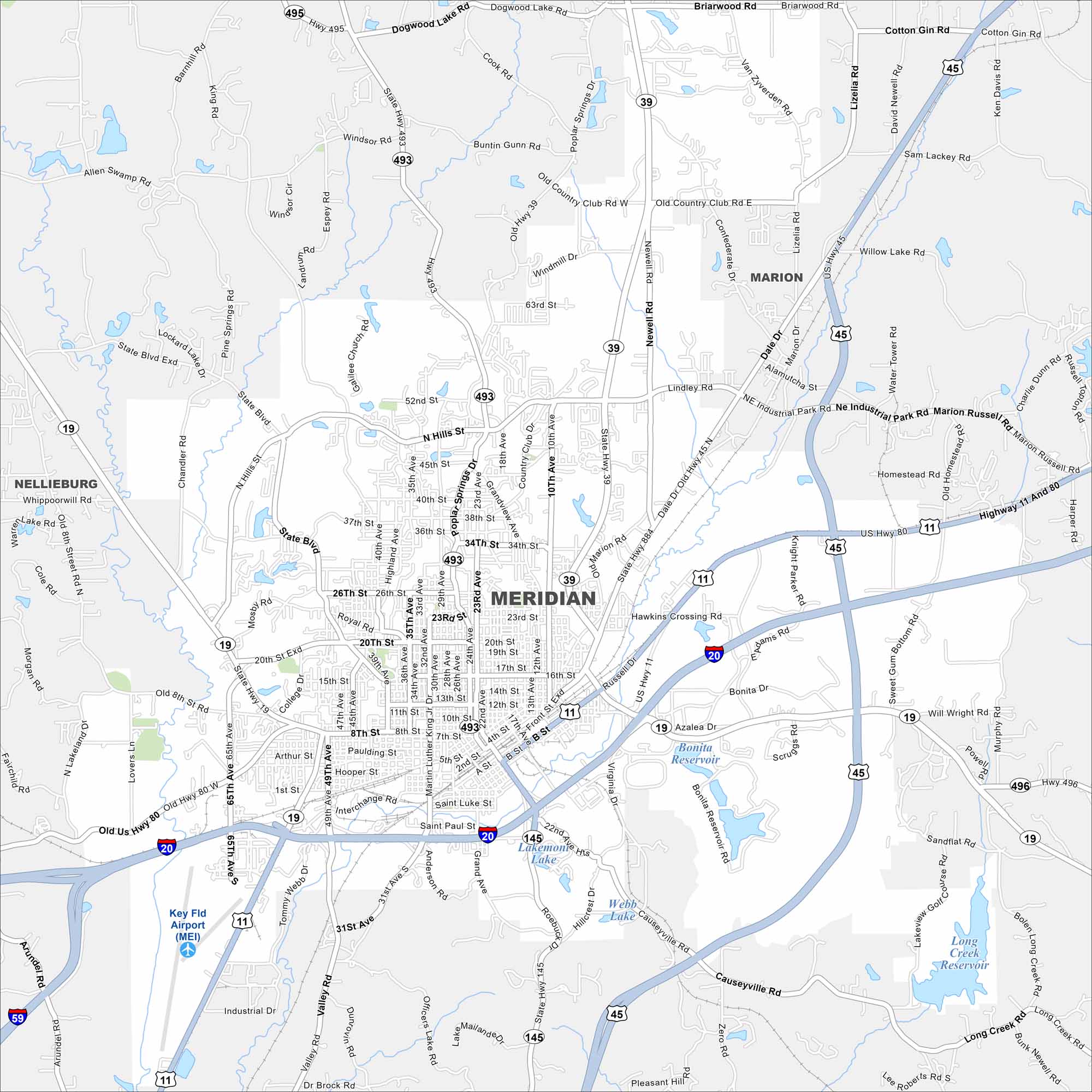
Check out Meridian with our road map. Railroads and highways converge here, shaping its layout. The city has long been a transportation hub with its eastern Mississippi location.
Map Information
On the Map
Interstates/Highways: I-20, I-59, US Hwy 45, US Hwy 11, US Hwy 80, State Hwy 19, State Hwy 39, State Hwy 493, State Hwy 495, State Hwy 145, State Hwy 496 Major Roads: 22nd Ave, 8th St, 14th St, 23rd St, 24th Ave, 29th Ave, 33rd Ave, 49th Ave, North Hills St, Poplar Springs Dr, Old Hwy 45, Dale Dr, Russell Dr, Bonita Dr, Front St, Saint Paul St, Grand Ave, Roebuck Dr, Valley Rd, Industrial Dr Airports: Key Fld Airport (MEI) Lakes and Reservoirs: Lakemont Lake, Bonita Reservoir, Long Creek Reservoir Nearby Communities: Nellieburg, MarionMississippi State Maps
Explore maps of Mississippi’s towns, rivers, and roads.


Mississippi City Maps
Discover Mississippi with our city maps