Map of Mesquite, Texas
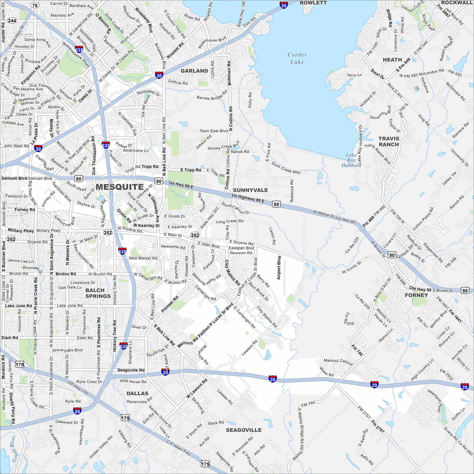
Explore Mesquite, located in the Dallas area. Our map shows highways, residential neighborhoods, and its road network. The city is known for its rodeo heritage.
Map Information
On the Map
Interstates/Highways: I-20, I-30, I-635, US Hwy 80, State Rte 352, State Rte 190, State Rte 66 Major Roads: Military Pkwy, Scyene Rd, Bruton Rd, Belt Line Rd, Town East Blvd, Galloway Ave, Gus Thomasson Rd, Motley Dr, Oates Dr, Barnes Bridge Rd, Collins Rd, Clay Mathis Rd, Faithon Lucas Blvd, Mesquite Valley Rd, Cartwright Rd, Lawson Rd, Gross Rd, Main St, Davis St, Pioneer Rd Lakes and Reservoirs: Lake Ray Hubbard, Corder Lake Nearby Communities: Dallas, Garland, Sunnyvale, Balch Springs, Seagoville, Forney, Rowlett, Heath, Travis RanchTexas State Maps
Scan our maps of the massive southern state of Texas.


City Maps of Texas
Explore our map collection of Texas cities.


