Map of Midlothian, Texas
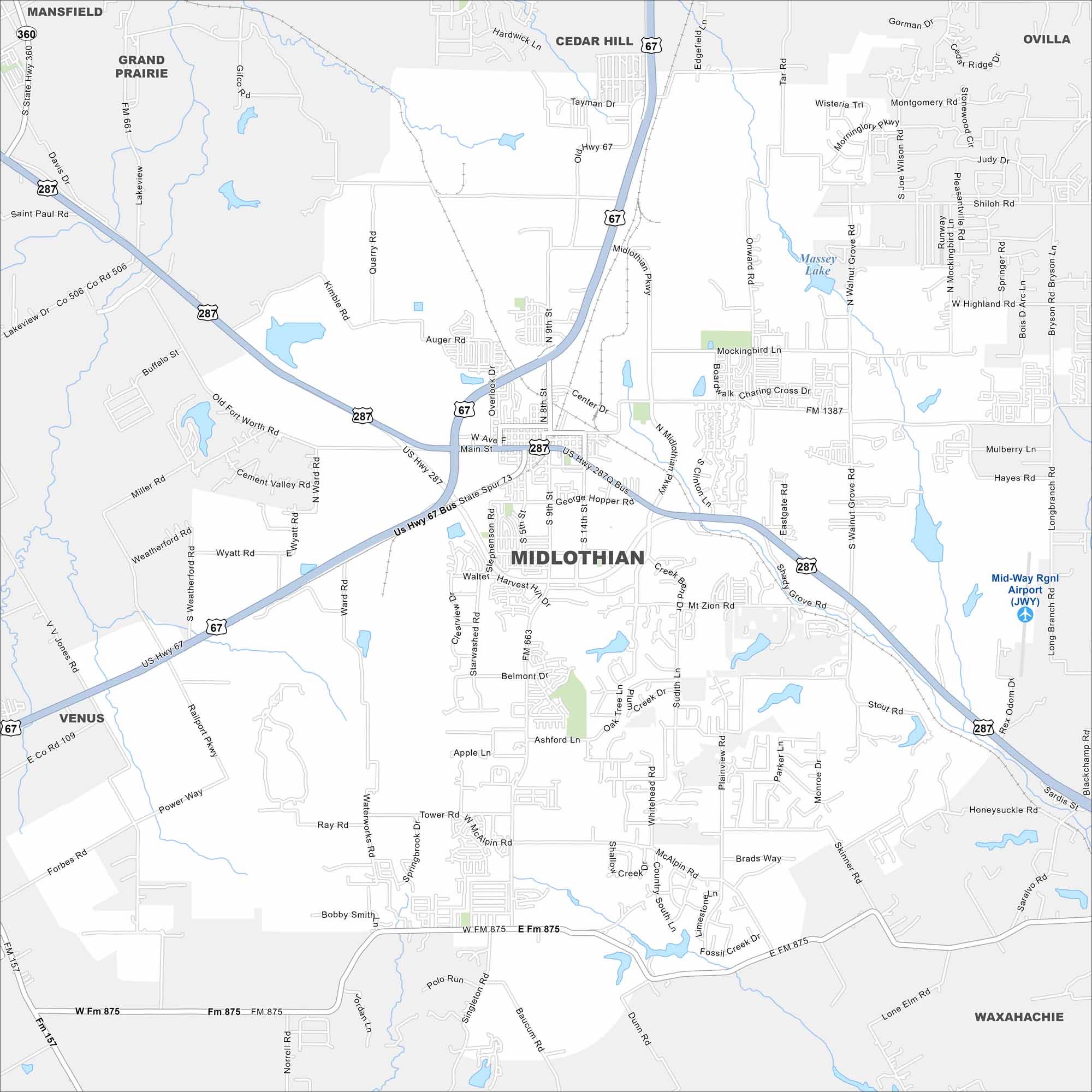
We’ve mapped out Midlothian, which is located southwest of Dallas. Cement plants and industry share space with new neighborhoods. Highways link it closely to the Dallas-Fort Worth metroplex.
Map Information
On the Map
Interstates/Highways: US Hwy 67, US Hwy 287 Major Roads: Midlothian Pkwy, Main St, 9th St, 8th St, 14th St, George Hopper Rd, Mt Zion Rd, Walnut Grove Rd, Shady Grove Rd, Mockingbird Ln, Kimmel Rd, Quarry Rd, Auger Rd, Wyatt Rd, Plainview Rd, McAlpin Rd, Singleton Rd, Baucum Rd, Dunn Rd, Lakeview Dr Airports: Mid-Way Rgnl Airport (JWY) Lakes and Reservoirs: Massey Lake Nearby Communities: Waxahachie, Cedar Hill, Venus, Grand Prairie, Mansfield, OvillaTexas State Maps
Scan our maps of the massive southern state of Texas.


City Maps of Texas
Explore our map collection of Texas cities.


