Map of Minnetonka, Minnesota
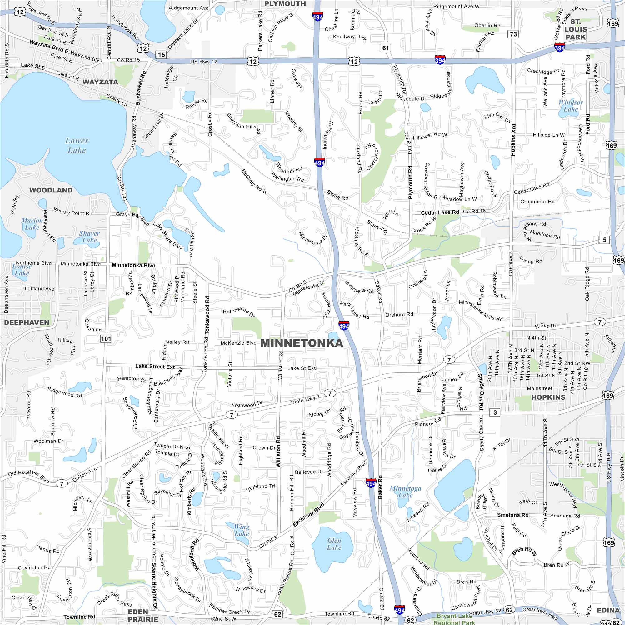
Our map of Minnetonka highlights its mix of lakes, parks, and neighborhoods. Highways connect it easily into Minneapolis. It’s a city defined by green space and water.
Map Information
On the Map
Interstates/Highways: I-494, I-394, US Hwy 12, US Hwy 169, State Rte 7, State Rte 62 Major Roads: Wayzata Blvd, Minnetonka Blvd, Lake Street Ext, Baker Rd, Hopkins Crossroad, Cedar Lake Rd, Shady Oak Rd, Excelsior Blvd, Townline Rd, Plymouth Rd, Williston Rd, Bren Rd, Smetana Rd, Mainstreet, Orchard Rd, Hilloway Rd, McGinty Rd, Ridgemount Ave, Crosby Rd, Bushaway Rd Lakes and Reservoirs: Lower Lake, Gray’s Bay, Wayzata Bay, Libbs Lake, Shaver Lake, Lake Louise, Minnetoga Lake, Wing Lake, Glen Lake, Windsor Lake Parks and Preserves: Bryant Lake Regional Park Nearby Communities: Plymouth, Wayzata, Woodland, Deephaven, Eden Prairie, Edina, Hopkins, St Louis ParkMinnesota State Maps
Explore every lake in our state maps of Minnesota


Minnesota City Maps
Browse through our city maps of Minnesota


