Map of Missouri City, Texas
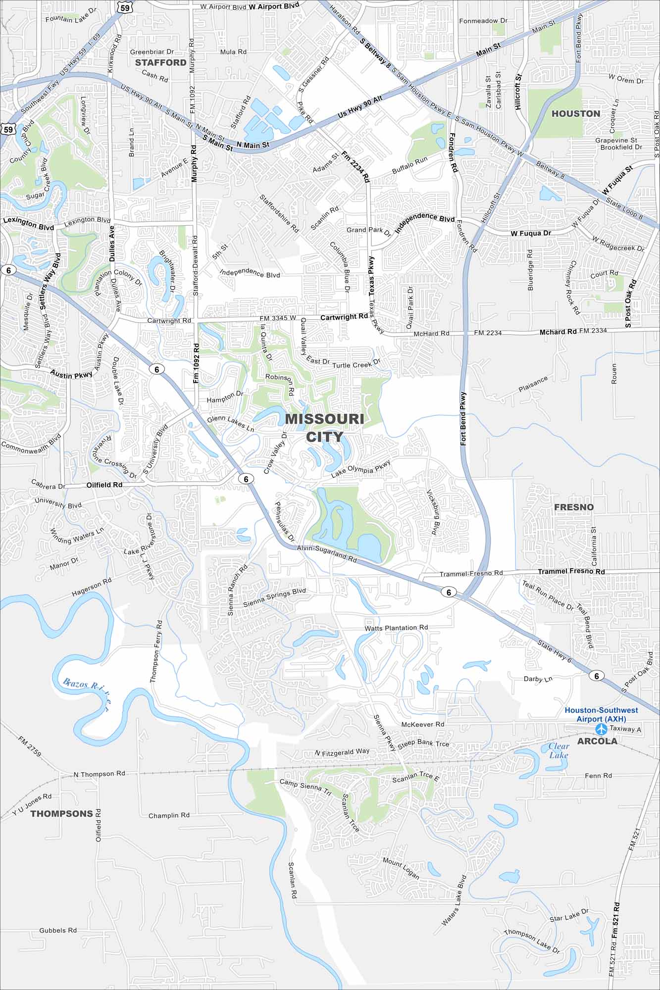
Explore Missouri City with our road map. Situated in Greater Houston, it’s a blend of parks and master-planned communities. Highways link it directly into the metro area.
Map Information
On the Map
Interstates/Highways: State Hwy 6, US Hwy 59 Major Roads: Beltway 8, Fort Bend Pkwy, Cartwright Rd, McHard Rd, Texas Pkwy, Murphy Rd, Independence Blvd, Dulles Ave, Lexington Blvd, Austin Pkwy, Sienna Springs Blvd, Watts Plantation Rd, Lake Olympia Pkwy, Vicksburg Blvd, Trammel Fresno Rd, Scanlan Trce, Airport Blvd, Gessner Rd, Stafford Rd, Main St Airports: Houston-Southwest Airport (AXH) Lakes and Reservoirs: Clear Lake Major Rivers: Brazos River Nearby Communities: Stafford, Houston, Fresno, Arcola, ThompsonsTexas State Maps
Scan our maps of the massive southern state of Texas.


City Maps of Texas
Explore our map collection of Texas cities.


