Map of Montrose, Colorado
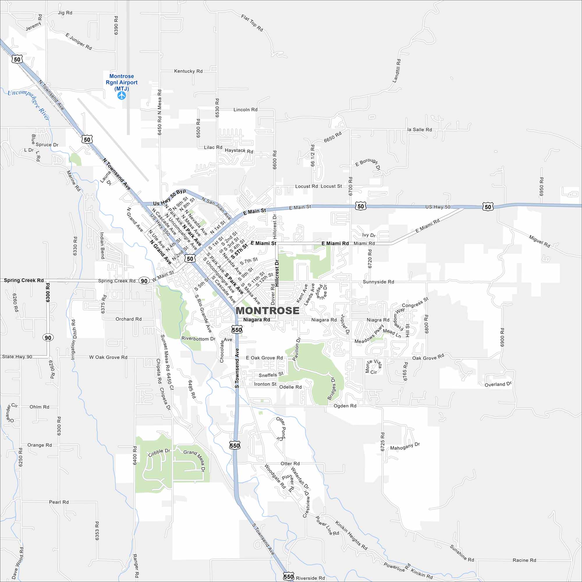
Montrose lies in western Colorado near the San Juan Mountains. Our map shows wide streets, farmland to the north, and mountain access to the south. It’s a jumping-off point for Black Canyon of the Gunnison.
Colorado State Maps
Browse Colorado with our detailed state maps


Map Information
On the Map
Interstates/Highways: US Hwy 50, US Hwy 550, State Hwy 90 Major Roads: Townsend Ave, Main St, Miami Rd, Niagara Rd, Grand Ave, Oak Grove Rd, San Juan Ave, Park Ave, Hillcrest Dr, 6700 Rd, 6725 Rd, 6800 Rd, 6900 Rd, Woodgate Rd, Otter Rd, Marine Rd, Lasalle Rd, 6450 Rd, 6300 Rd, Sunnyside Rd Airports: Montrose Rgnl Airport (MTJ) Major Rivers: Uncompahgre RiverColorado City Maps
Here are maps of Colorado’s urban areas


