Map of Muscatine, Iowa
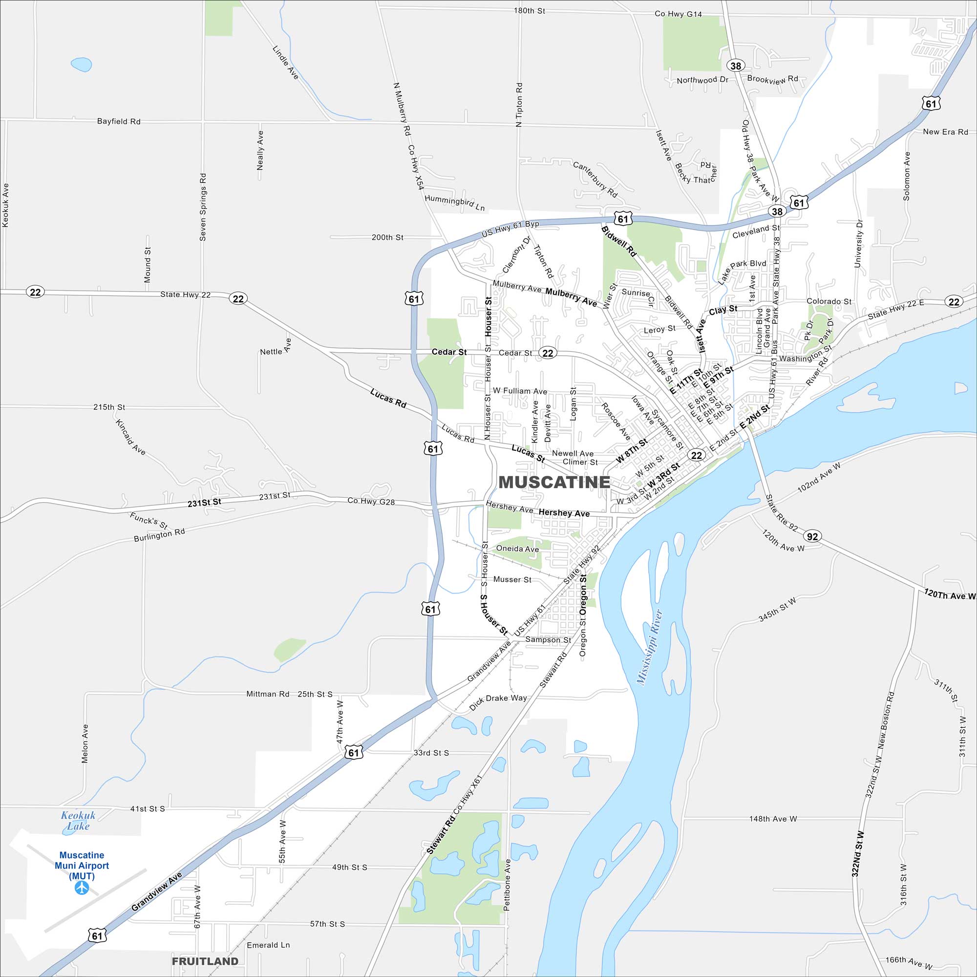
Muscatine sits on the Mississippi River in eastern Iowa. Our map highlights its riverfront, downtown streets, and surrounding parks. The city has long been tied to the pearl button industry.


Map Information
On the Map
Interstates/Highways: US Hwy 61, US Hwy 61 Byp, State Rte 22, State Rte 38, State Rte 92 Major Roads: Grandview Ave, Hershey Ave, Mulberry Ave, Houser St, Park Ave, University Dr, Tipton Rd, Bidwell Rd, Isett Ave, Oregon St, Fulliam Ave, Cedar St, Lucas Rd, Colorado St, Clay St, 2nd St, 5th St, 8th St, 11th St, Dick Drake Way Airports: Muscatine Muni Airport (MUT) Major Rivers: Mississippi River Nearby Communities: FruitlandIowa City Maps
Browse city maps in the state of Iowa


