Map of Muskogee, Oklahoma
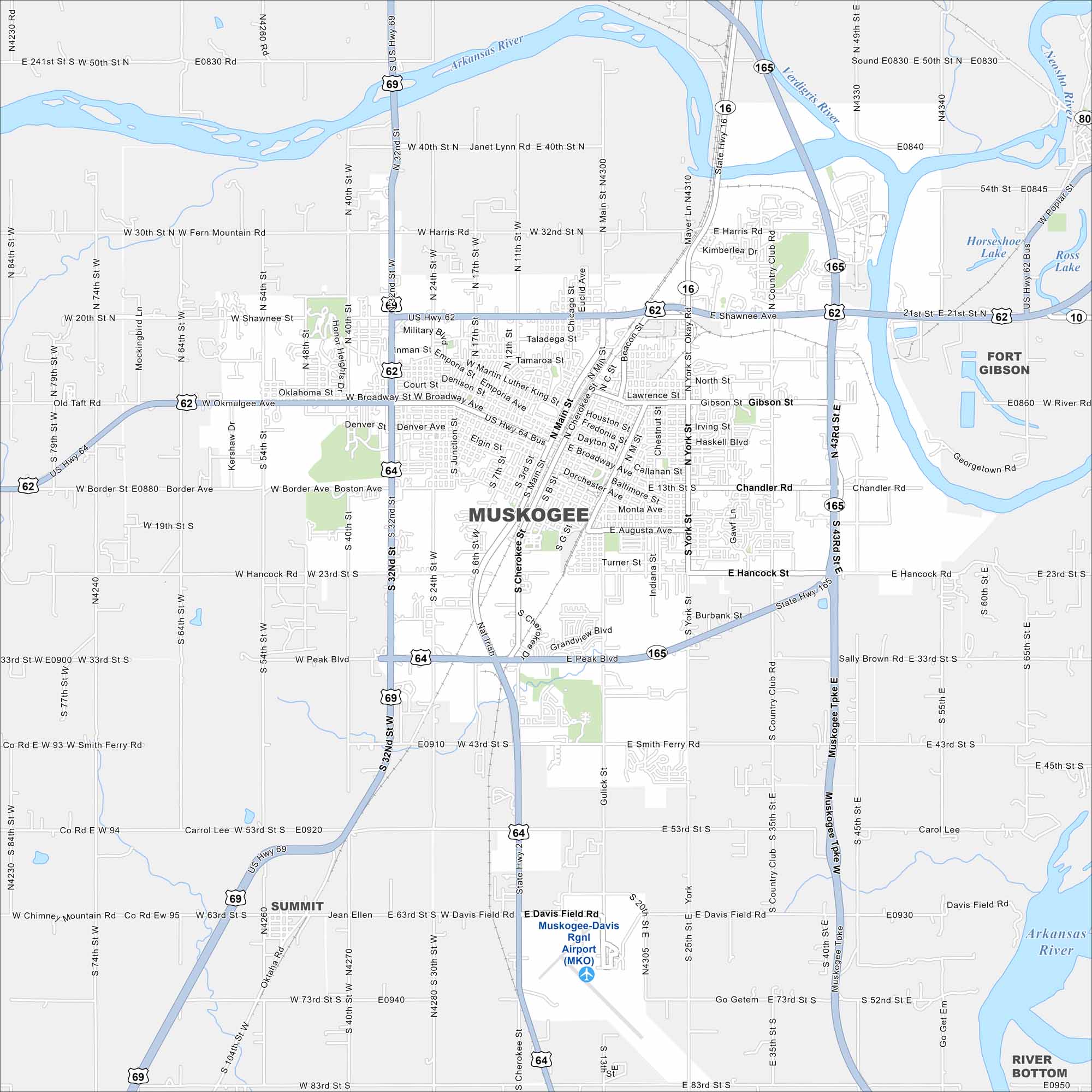
Get to know Muskogee by checking our map of eastern Oklahoma. It sits at the confluence of the Arkansas, Verdigris, and Grand Rivers. The city is deeply tied to regional history and music.
Map Information
On the Map
Interstates/Highways: US Hwy 62, US Hwy 64, US Hwy 69, State Rte 16, State Rte 165 Major Roads: Broadway Ave, Okmulgee Ave, Peak Blvd, 32nd St, 24th St, main St, York St, Country Club Rd, Shawnee Ave, Harris Rd, Border Ave, Hancock Rd, Smith Ferry Rd, 43rd St, Gibson St, Chandler Rd, military Blvd, court St, Denver Ave, Grandview Blvd Airports: Muskogee-Davis Rgnl Airport (MKO) Lakes and Reservoirs: Horseshoe Lake, Ross Lake Major Rivers: Arkansas River, Verdigris River Nearby Communities: Fort Gibson, SummitOklahoma State Maps
Here is our map collection of the Sooner State.


City Maps of Oklahoma
Explore Oklahoma’s cities with our maps


