Map of Nederland, Texas
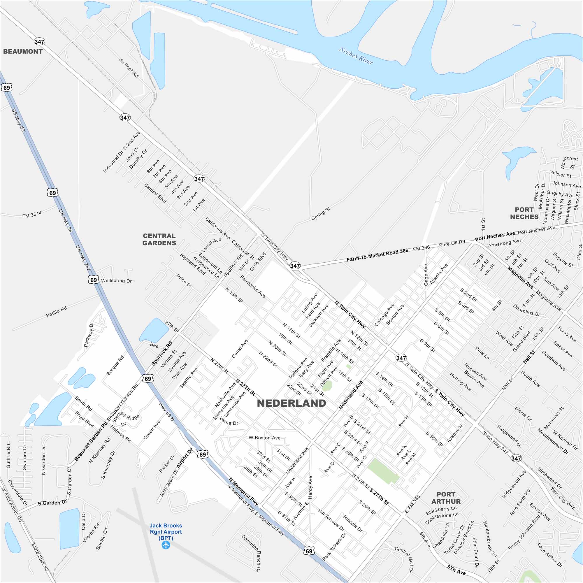
Check out Nederland with our map of the Golden Triangle region. The layout shows a small grid of roads surrounded by industry and refineries. It’s closely tied to Port Arthur and Beaumont.
Map Information
On the Map
Interstates/Highways: US Hwy 69, US Hwy 96, US Hwy 287, State Hwy 347, State Hwy 93 Major Roads: Twin City Hwy, Memorial Fwy, Nederland Ave, Port Neches Ave, Magnolia Ave, Nall St, Pure Oil Rd, Helena Ave, Spurlock Rd, Beauxart Garden Rd, Airport Dr, Central Blvd, California Ave, Highland Blvd, 27th St, 17th St, 12th St, 9th Ave, Grigsby Ave, Armstrong Ave Airports: Jack Brooks Rgnl Airport (BPT) Major Rivers: Neches River Nearby Communities: Beaumont, Central Gardens, Port Neches, Port ArthurTexas State Maps
Scan our maps of the massive southern state of Texas.


City Maps of Texas
Explore our map collection of Texas cities.


