Map of New Braunfels, Texas
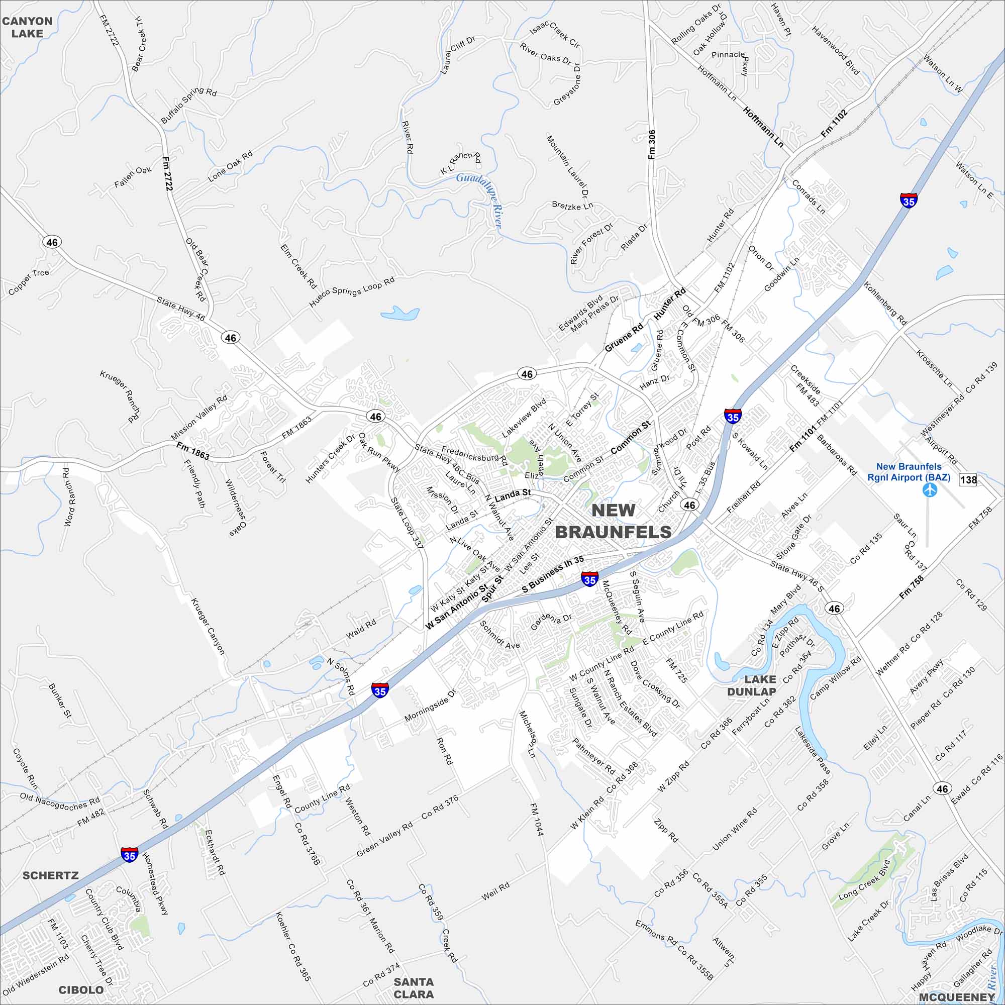
New Braunfels lies between Austin and San Antonio. Take a look at this map to see the Guadalupe and Comal Rivers running through town. The city has deep German roots and is home to Schlitterbahn water park.
Map Information
On the Map
Interstates/Highways: I-35, State Hwy 46, State Hwy 123 Major Roads: Common St, Seguin Ave, San Antonio St, Landa St, Walnut Ave, Loop 337, County Line Rd, Zipp Rd, Klein Rd, Mary Blvd, Barbarosa Rd, Kohlenberg Rd, Hunter Rd, Post Rd, Union Wine Rd, Green Valley Rd, Solms Rd, Morningside Dr, Mission Valley Rd Airports: New Braunfels Rgnl Airport (BAZ) Major Rivers: Guadalupe River Nearby Communities: Schertz, Cibolo, Santa Clara, McQueeneyTexas State Maps
Scan our maps of the massive southern state of Texas.


City Maps of Texas
Explore our map collection of Texas cities.


