Map of Newton, Massachusetts
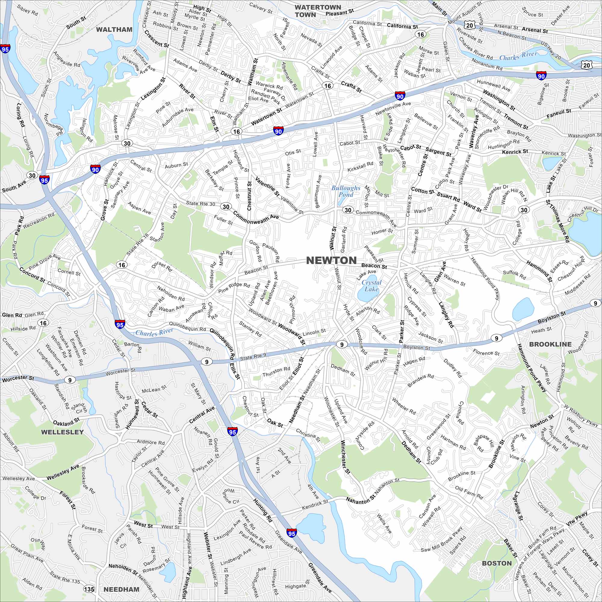
Newton lies just west of Boston with villages spread across rolling terrain. Check out our map to see its winding streets and rail lines. The Charles River defines part of the city’s edge.
Map Information
On the Map
Interstates/Highways: I-95, I-90, State Rte 9, State Rte 16, State Rte 30, US Hwy 20 Major Roads: Commonwealth Ave, Beacon St, Washington St, Walnut St, Center St, Boylston St, Needham St, Dedham St, Winchester St, Nahanton St, Parker St, Hammond Pond Pkwy, Auburn St, Homer St, Lowell Ave, Adams St Lakes and Reservoirs: Crystal Lake, Bulloughs Pond, Hammond Pond Major Rivers: Charles River Nearby Communities: Waltham, Watertown Town, Brookline, Boston, Needham, WellesleyMassachusetts State Maps
Here’s our state maps of Massachusetts


City Maps of Massachusetts
Explore Boston and other urban areas in Massachusetts


