Map of Wylie, Texas
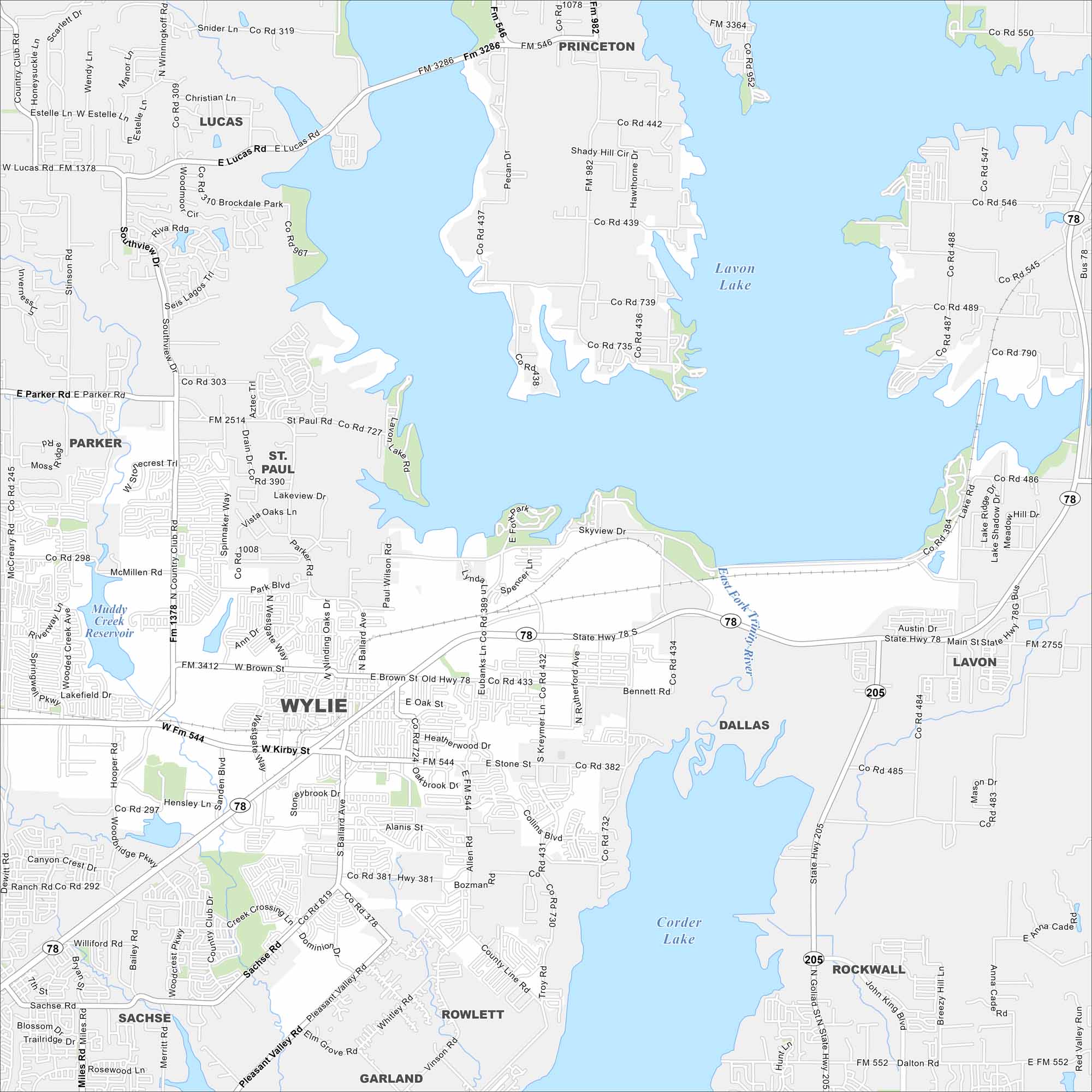
Our map of Wylie shows this fast-growing community outside of Dallas, Texas. It’s known for its historic downtown and nearby Lake Lavon and Lake Corder.
Map Information
On the Map
Interstates/Highways: State Rte 78, State Rte 205 Major Roads: Main St, Kirby St, Brown St, Stone Rd, Ballard Ave, Alanis Dr, Hensley Ln, Hoope Rd, Westgate Way, Park Blvd, McMillen Rd, Ballard Ave, Birmingham St, Eubanks Ln, Kreymer Ln, Rutherford Ave, Bennett Rd, Parker Rd, Lucas Rd, Country Club Dr Lakes and Reservoirs: Lavon Lake, Corder Lake, Muddy Creek Reservoir Major Rivers: East Fork Trinity River Nearby Communities: Lucas, St. Paul, Parker, Lavon, Rockwall, Rowlett, Sachse, Garland, PrincetonTexas State Maps
Scan our maps of the massive southern state of Texas.


City Maps of Texas
Explore our map collection of Texas cities.


